
Day 58-61: Back on Trail
August 18-21; Mile 843-896
Day 58
After four days off to attend a friend’s wedding and to spend time with Dov, it was time to return to trail. We drove up to Dubois, WY and picked up Strix, Handy, and Lark, and then Dov drove us all out to the trail. I would definitely be taking it easy: we only had about 50 miles to do until our next town stop, where we had already planned for a zero.

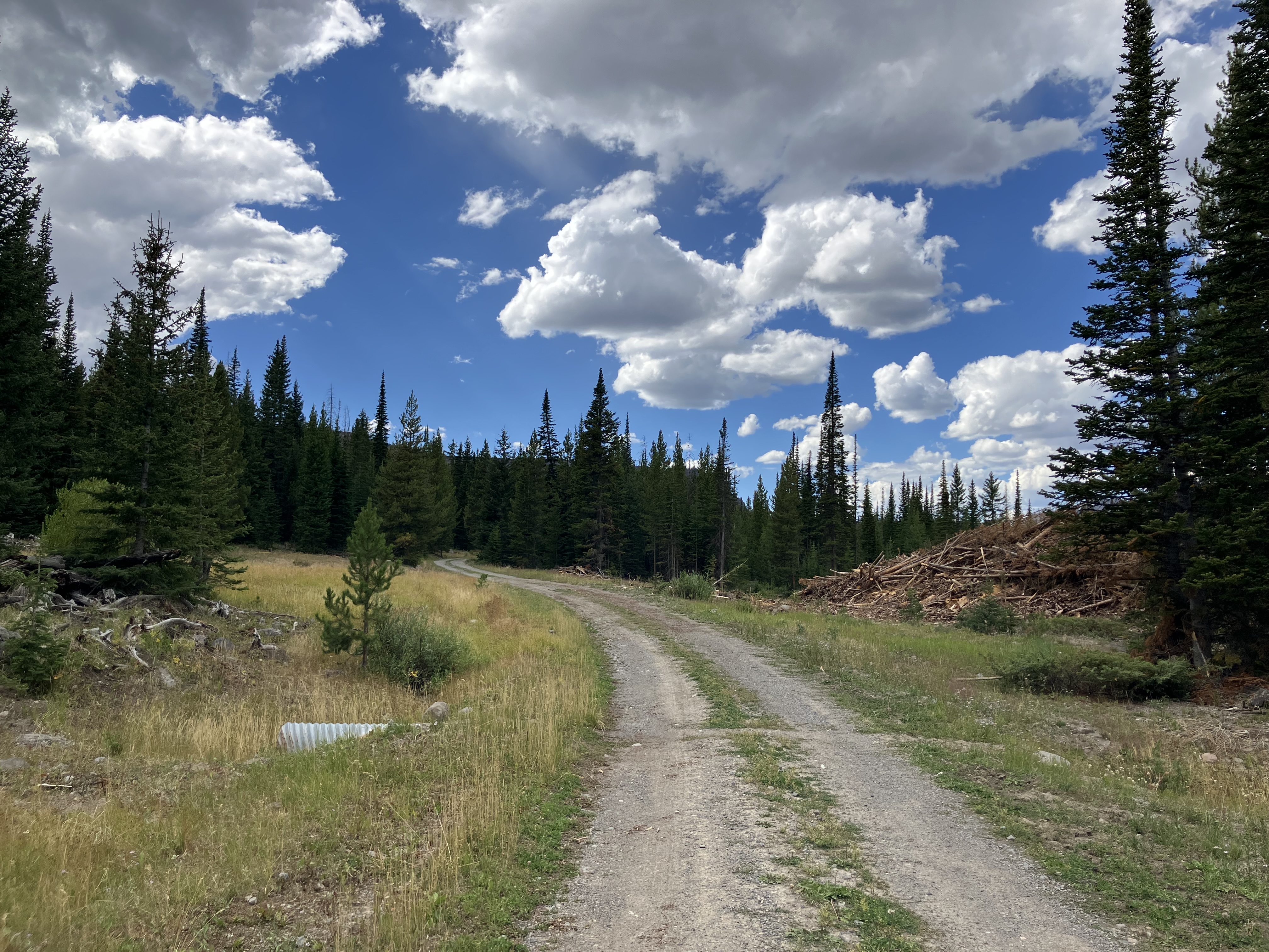
Soon I was back on the CDT, hiking up along another dirt forest road. It wasn’t exactly the type of scenery that draws you back to the trail, but at least it was relatively flat.
We had a few nice views of the Pinnacle Buttes to our north, but much of the trail that day was filled with slash piles, drainage culverts, burn scars, and forest roads. There were some tricky navigation decisions, and often the less-clear option turned out to be the actual CDT. Strix had paused to pee before one of the junctions, and when I didn’t see her after an hour, I assumed she was on another navigational “adventure.”
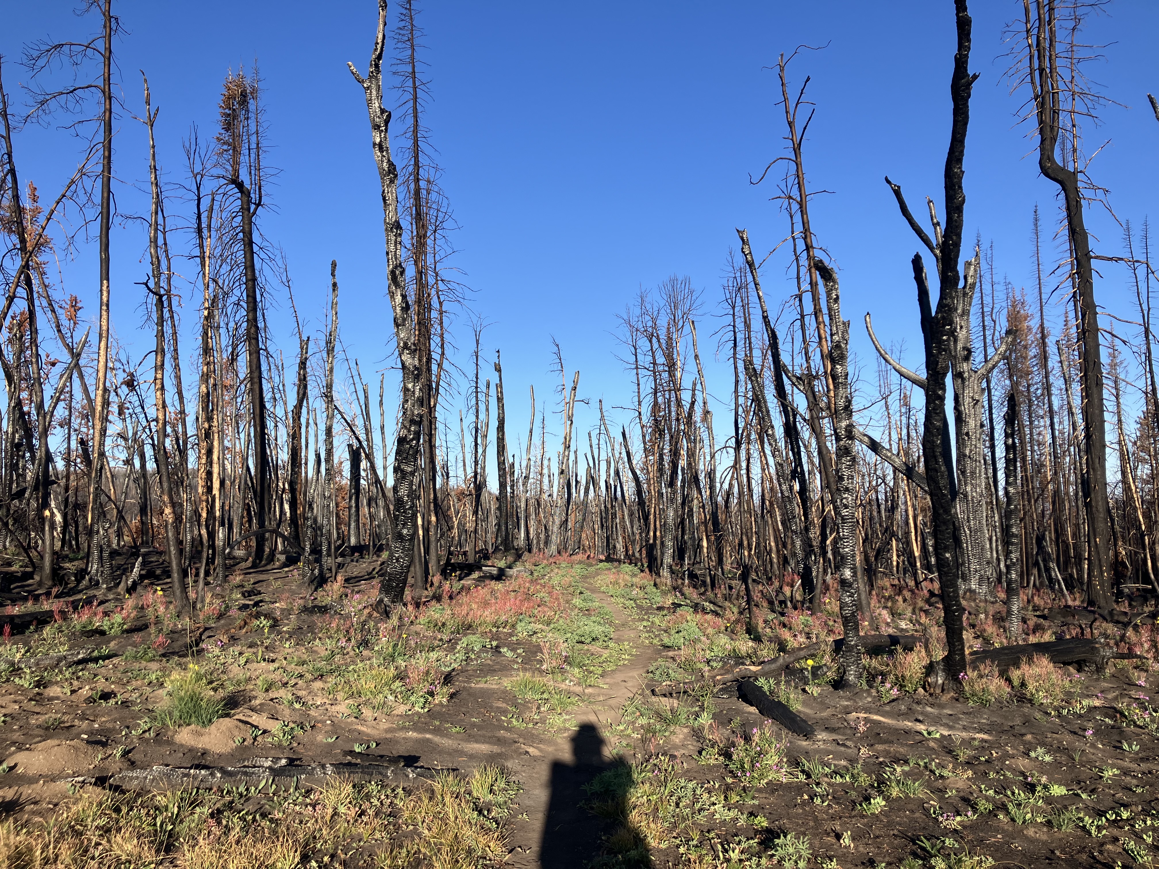
Just as pollution makes for beautiful sunsets, the burn scars afforded some wide open views of the surrounding mountains. Gray clouds sulked above us, sprinkling briefly just enough to kick up the wet dirt smell. The trail wove in and out of burn scar, the ground still ashy black after only a year.
About a mile from camp I came to a nice stream and filled up 2 liters. We would be dry camping tonight, but water was pretty abundant in this stretch. The other two hikers there said that I had just missed Handy and Lark, and so I didn’t stay long. I was reflecting on how sections of the trail had been somewhat inscrutable today – with berms to climb over onto disused forest roads and easy-to-miss hairpin turns – and then I got a funny feeling when the path I was on fanned out into three braided options. Once again, I had been tricked by the cows, and so I found myself going cross-country through burn scar and marshy grass toward our camp spot for the night.
Lark and Handy were just setting up as I arrived, and within minutes Strix appeared after having taken an exciting route past Pelham Lake. We ate dinner by the road, and at one point Handy asked Strix, “What bird was that?”
We all stopped and listened intently as a distant moo carried across the fields. “That was a cow,” she laughed. But as we lay in our tents with the sky turning purple, a Great Horned owl called into the night. A few moos followed, and then a loud canine howl. The cry pierced the quiet evening, and other howls rang out from all directions in a growing chorus. There were a few barks and yips interspersed in the howls, so although I wish they had been wolves we were hearing, most likely it was a pack of coyotes.
Day 59
The meadow grasses glittered with frost as I hiked out at sunrise. The trail led down into a basin that was bathed in pink from the early morning light. Cows meandered throughout, and I took extra care to check my map and ensure I stayed on trail.
Before long I was back into fresh burn scar, clambering over deadfall and shuffling through black ash. Through the remaining trees I got a glimpse of the Tetons with a smudge of gray near the peaks. I passed into more meadowland – a fairly flat and meandering section – at almost the same elevation as Targhee Pass.
Strix and I stopped to filter water from a little stream, and I showed her the upcoming alternate I was considering taking. Handy showed up soon after, and we all decided to diverge from the CDT for some sweeping views.
Strix was ahead of me when I got to the junction. To our left lay a marshy patch with a beaver dam, and beyond it was the jeep trail we were trying to reach. Strix was edging her way around the marsh, and I tried my hand at crossing further upstream. The stream bent back on itself repeatedly, so that I had to hop across three times, but the ground was firm. After that I cut across the hill through the sagebrush and climbed up the jeep track. Five minutes later I spotted a raptor flying erratically in circles, crying out an attempt at its normal call. It was a young red-tailed hawk! It seemed like it was still getting the hang of being a hawk.
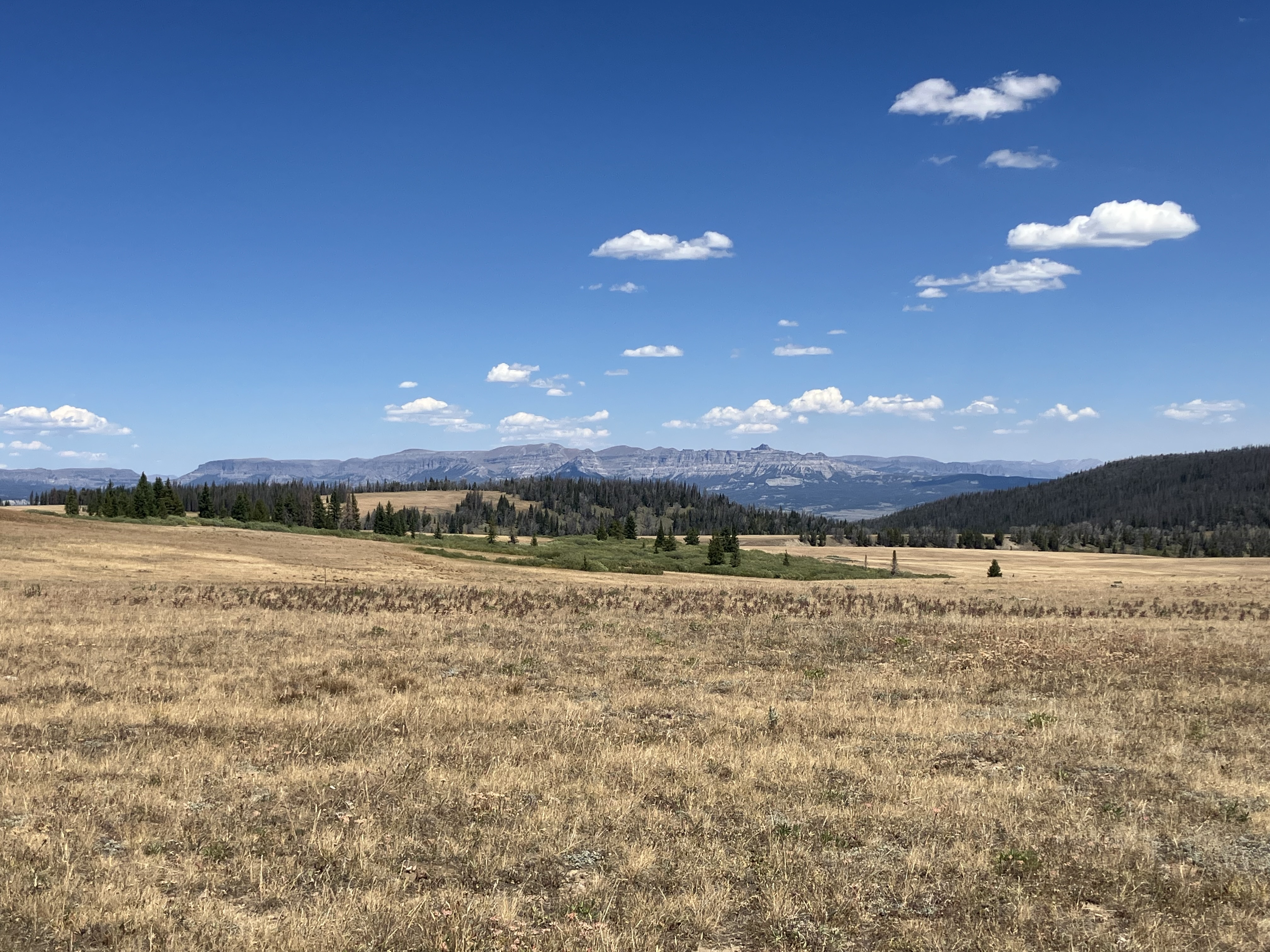
The road led up to a grassy plateau with views in all directions: the Winds to our south, the Gros Ventre Wilderness to the west, the Absaroka Range to the northeast, and to the northwest – where the Tetons would have been visible – a great wall of smoke.
I watched the gray tentacles creeping forward, blotting out the peaks of the Gros Ventre Range and stretching toward the Winds. A strong wind was blowing from the direction of the smoke, stretching its sickly pallor across the sky.
I stopped for a break, and two separate groups of people driving along the jeep track asked if I was alright, and if I wanted some water or perhaps “a package of nuts.” Mostly I wanted some rain to clear the air.
As I descended back to the CDT, I came across Strix reclining in the shade. She had missed the jeep track and tried following a different road before giving up and heading back to the trail. We laughed about her misadventures in this section before hiking on toward Lake of the Woods. Thick smoke was blowing down across the grassland, and the distant peaks had all but disappeared. We came to another beaver dam that had flooded the trail, and I tried in vain to find a path around before succumbing to walking barefoot through the mucky water. Strix hiked ahead in her sandals while I rinsed off my feet, and as I sat there the features around me blurred in the haze. I finally took out my N95 mask and hiked the last half mile to camp while wearing it.
Day 60
Thankfully the smoke cleared, and when I woke up a dark cloud was drifting away after sprinkling onto our tents.
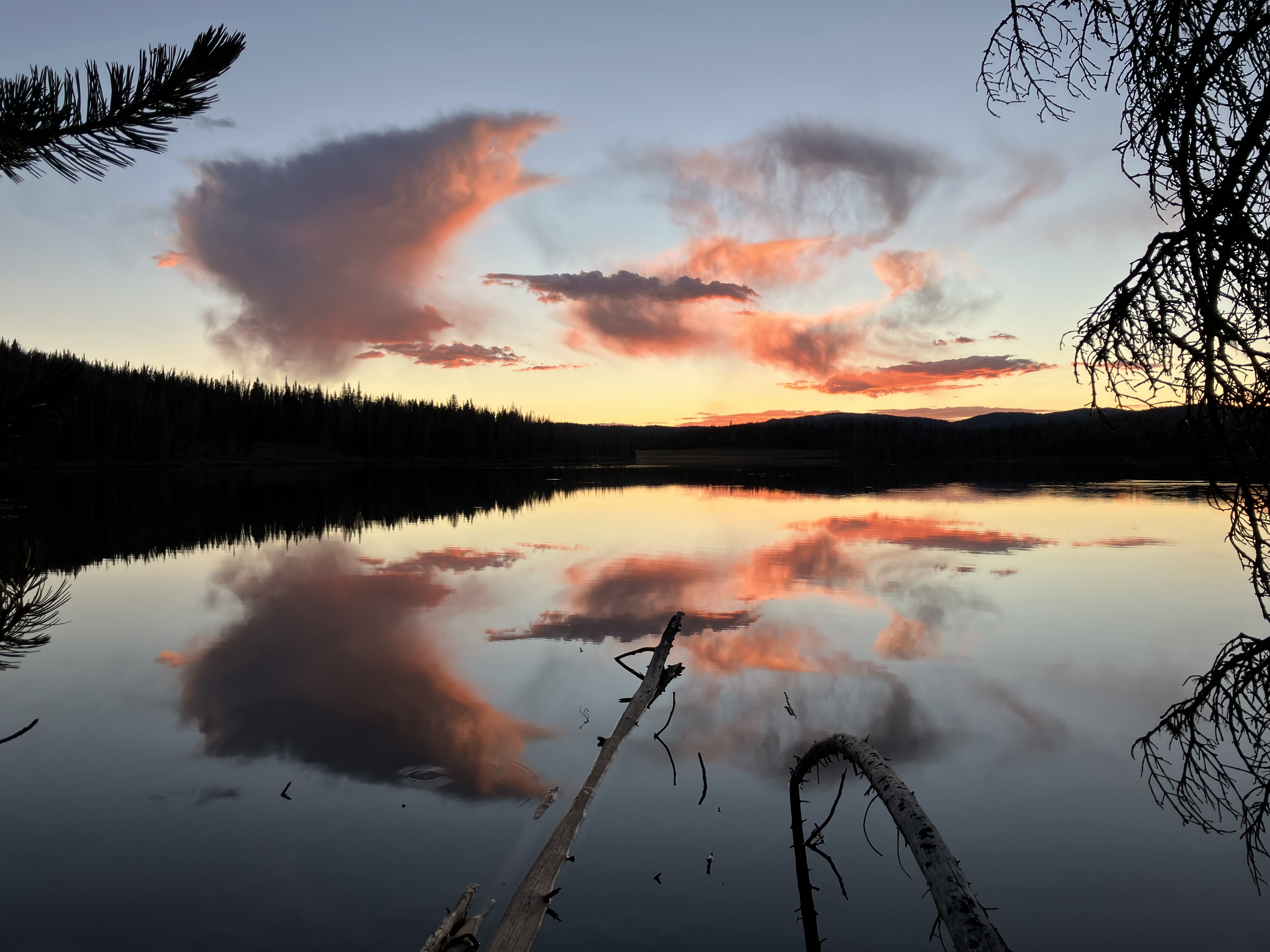
I hiked around the lake, pausing to marvel at the brilliant oranges and pinks reflected in the water at sunrise. I knew the trail hugged the lake for about a mile, but sadly I hugged it a little too tightly and wound up off-trail. But, I got to watch some sandhill cranes dancing and squawking out an alert call, so it wasn’t a complete loss.
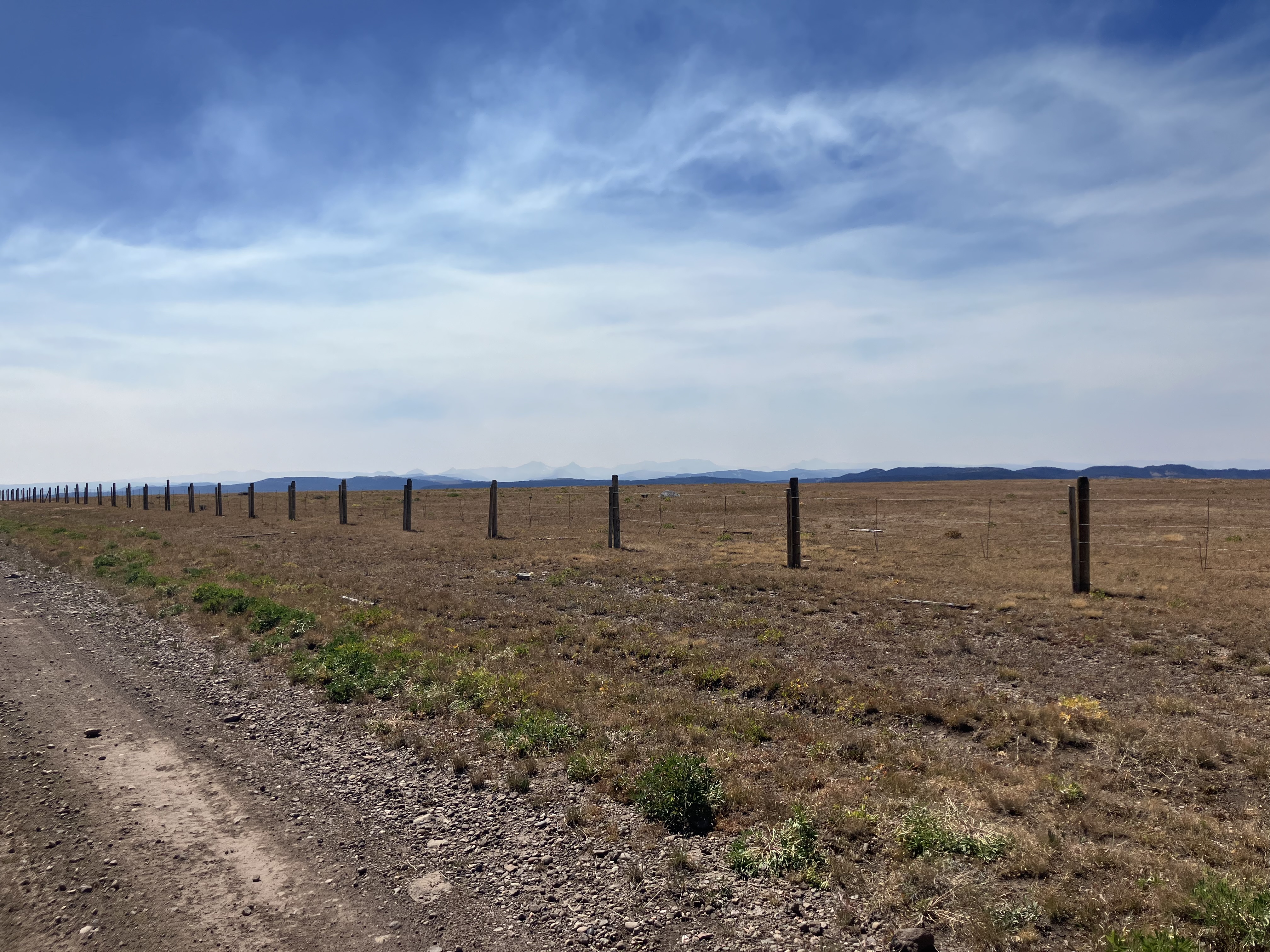
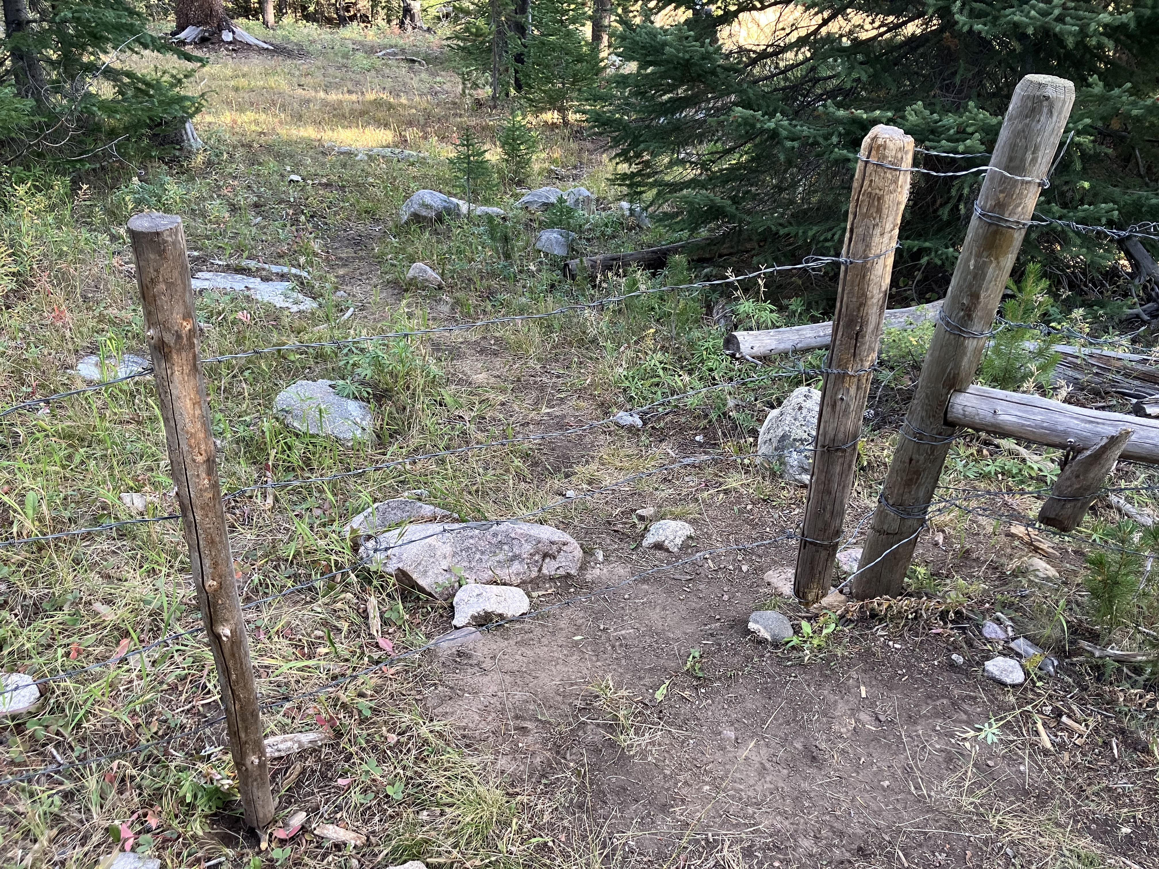
The trail led across open meadows filled with cows – something we would soon be leaving behind as we entered into the Bridger Wilderness area. I was very happy to be leaving behind the janky barbed wire fences, too, as I fought to open another one and struggled to close it just as Handy caught up.
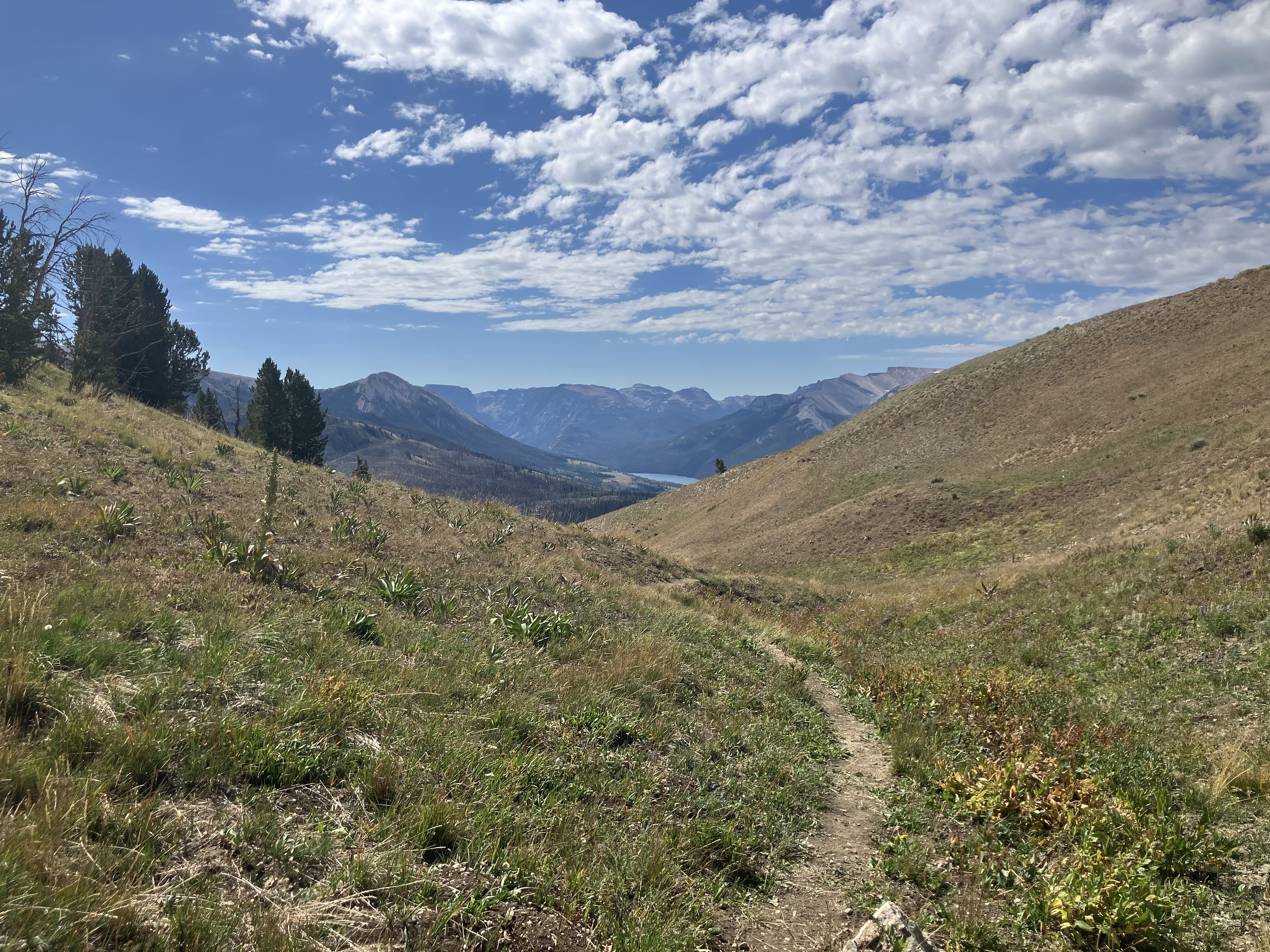
Soon the path began to ascend up toward Gunsight Pass, the official/unofficial beginning of the Wind River Range, and the spot where some claimed the grizzly territory ended. I’d be bringing my bear spray all the way through the Winds, though.
Beyond the pass lay Green River Lakes, and familiar peaks from my backpacking trip six years ago. I descended down through the forest and wound my way through stands of aspens dotted with clumps of yellow where their leaves were just beginning to turn. In the next burn scar the fireweed carpeting the ground had gone to seed, its leaves aflame in oranges and reds. Autumn was creeping its way back into the high country.

I hurried along the trail, a bit behind schedule from my detour to the cranes and from the rougher terrain. Pine needles carpeted the ground, and I had to keep stopping to take off my shoes since the needles would wedge themselves at the front of my shoe and stab the tip of my big toe on the descents. At one point a mighty gust of wind blew between the trunks of the pines, and as I looked toward my right I noticed a cloud of pine needles borne upon the gust. They pinged against my pack and pelted my face and arms in a brief but fierce attack.
At last I crested the top of the hill on the final descent to the river, passing back into sagebrush and escaping from the pine needles. At the end of the road lay a trailhead, and somewhere in that trailhead lot Dov was waiting with cold drinks and sandwich supplies.
We all piled into the car with our packs shoved Tetris-like in the back. It was a long, rough road back to Pinedale, made rougher when the car got a flat after only 10 miles. Out came all the packs again, as well as all of Dov’s luggage, and we swapped out the flat with the temporary tire – with still more washboarded and unpaved road ahead. It was a nervous ride, and we all breathed a sigh of relief when the tires hit the pavement.
Day 61
Pinedale made for an excellent stop, including running into old friends Panty Pirate, Steamy, Treebeard, and Pops.
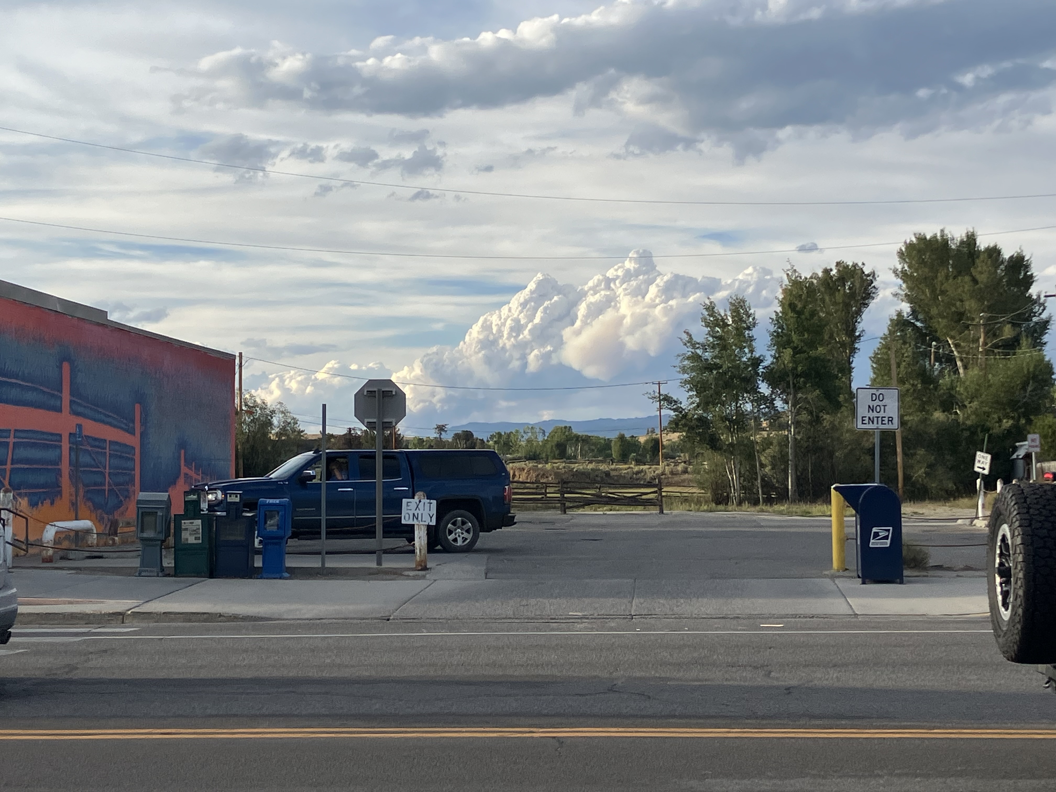
But at 3PM on our zero day, my phone alerted about a fast-growing fire along the Green River Lakes road.
An hour later it had grown to 20 acres, and by dinner it was 600 acres and coughing out a massive plume of smoke visible from town. The road back to our trailhead was closed, and I scrambled to find another way into the Winds, the crown jewel of the CDT.
2 Comments
Kate
I immediately looked up the Dollar Lake Fire on inciweb (my home page during fire season). I’m glad you’re mostly through that section and out of the smoke by now, and I do hope nothing new has appeared in the meantime (according to inciweb, nothing has).
The terrain (alpine tundra-type vegetation) is so familiar. It’s nice to see such lovely photos of it. The fireweed is a good reminder that fire doesn’t destroy the terrain, it just allows it to have a new face.
Keep the photos and musings coming.
Ray
Gunsight Pass . . . aptly named! Fire and smoke again becoming one of your journal hallmarks . . .