
Day 46-49: The Centennials
August 6-9; Mile 718-790
Day 46
I was about a mile from camp when I happened to look to my left. Barely 50 feet away, a moose was picking its way quietly down the drainage, weaving between the burnt trees and leafy bushes. It was a young bull, with just a small stub sprouting from its forehead, and I watched in rapt silence as it sidled past me. I took several videos and photos, and at the quiet rustle from me stowing my phone in my pocket, the moose swung its head my direction and fixed its beady eyes on me. I quickly made my exit, hiking up the hill and scrambling over some deadfall. It watched me until I was over the downed trees, and then it continued its languid survey of the bushes on the hillside, pausing to sample a few on its way downhill.

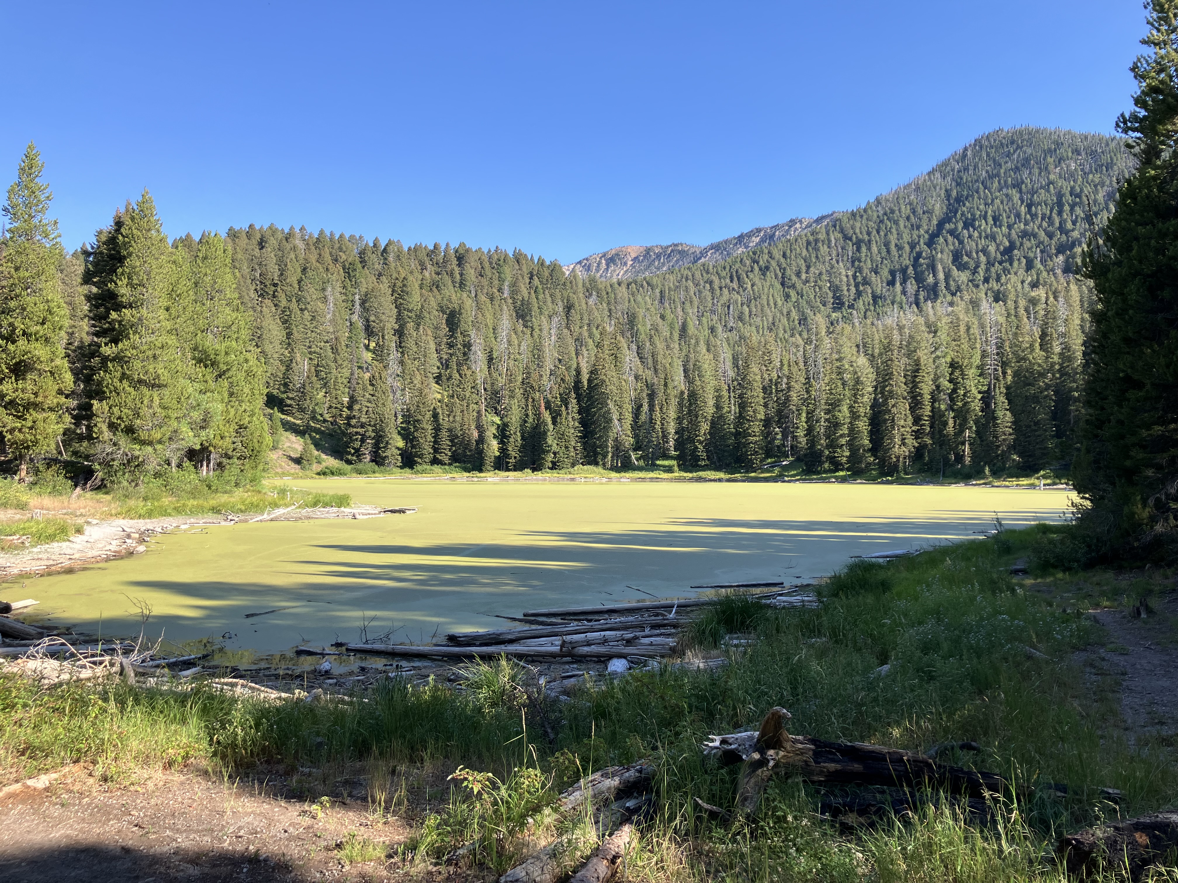
I hiked on through the dying meadows until reaching Aldous Lake. I had planned to take a long break there, but the lake had a thick layer of green muck across its entire surface. Yuck. Strix and Lark caught up as I was about to leave, and we picked a spot to eat lunch together.
After hundreds of miles of what counted as trail on the CDT, the next mile and a half was a dream: smooth, wide dirt you could walk four across. There were volunteers out that morning maintaining the trail, and they cautioned me that a section was a little rough. I laughed and told them it was still better than what I had been walking on. The trailhead lay nearby with yet another register to check the progress of our friends.
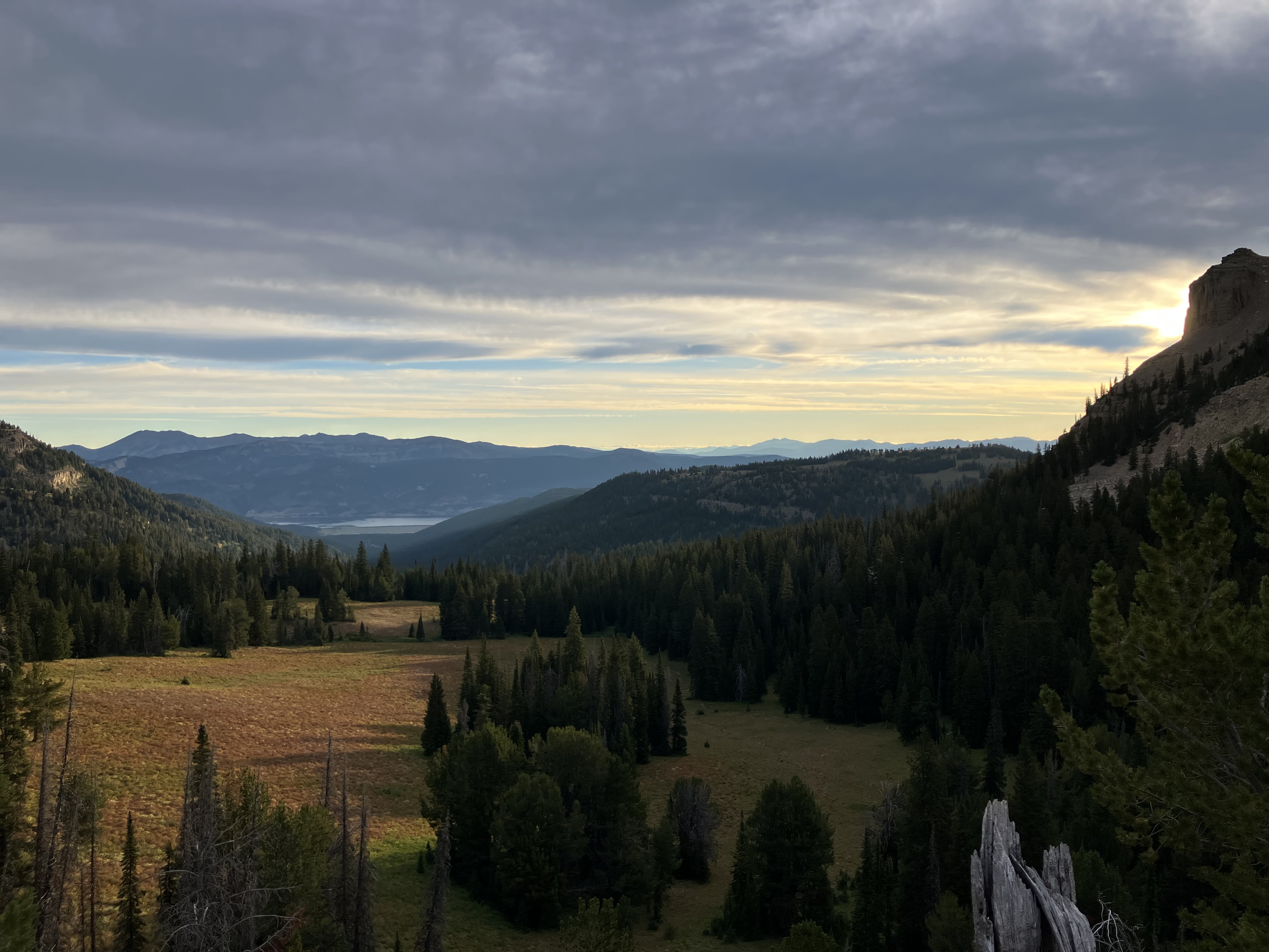
Much of the day was hot with clear skies, and the trail led through forest with patches of drying grassland and meadow. We paused near a stream – the last water for a while – and had to move twice to stay in the shade. Meemaw paused on her way past and ended up joining us for lunch. She and Dump Gloves were planning to take the alternate route to Yellowstone via Island Park instead of stopping in West Yellowstone, which would put them a day or two ahead of us. Hopefully we would see them again somewhere in Colorado.
Before starting the climb, I dunked my hat and shirt in the icy stream and pulled the clingy fabric back on. The air was thick and warm, but the climb was filled with wild raspberries, and I stopped often to pick the little fuzzy wonders.
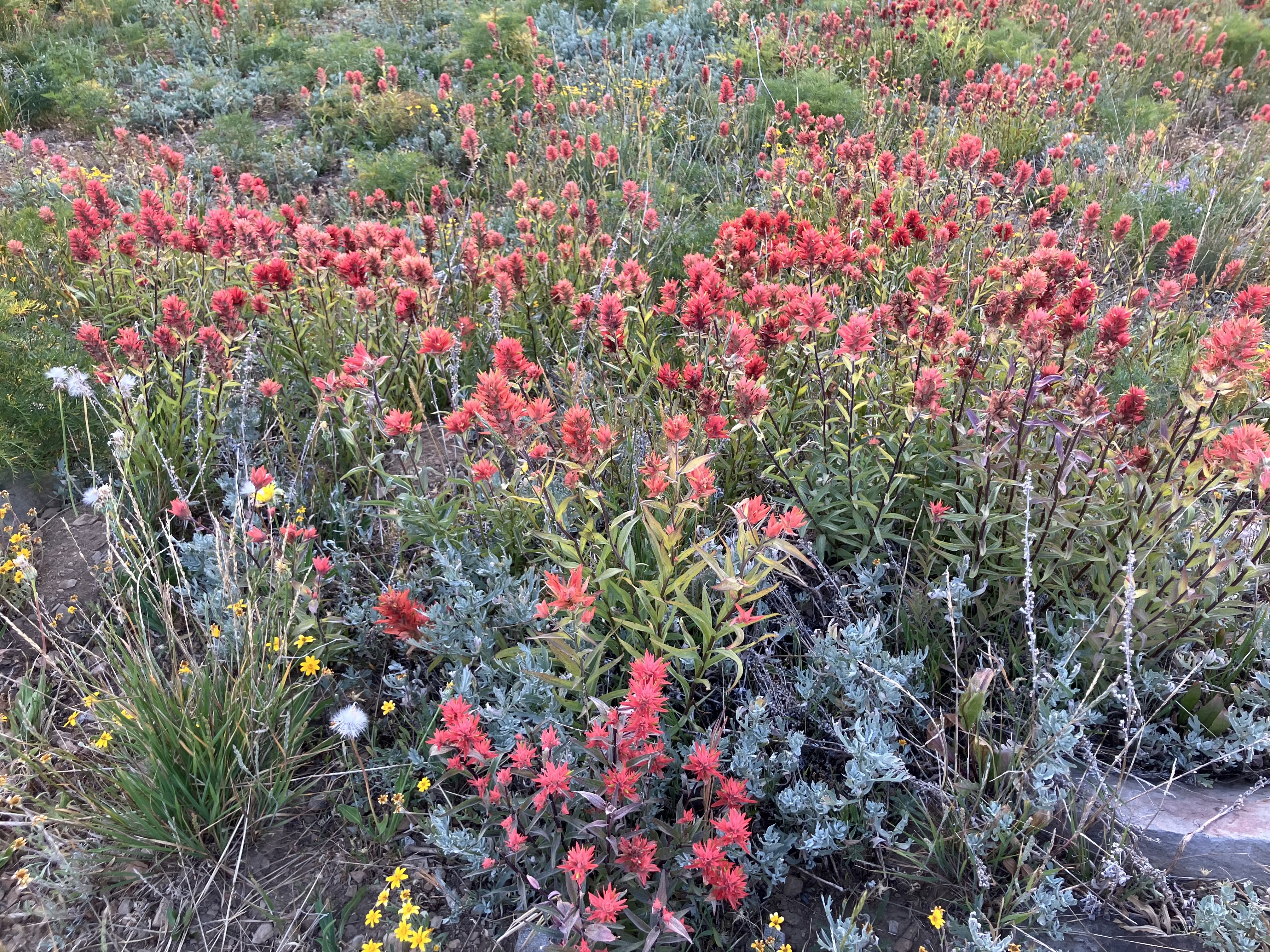
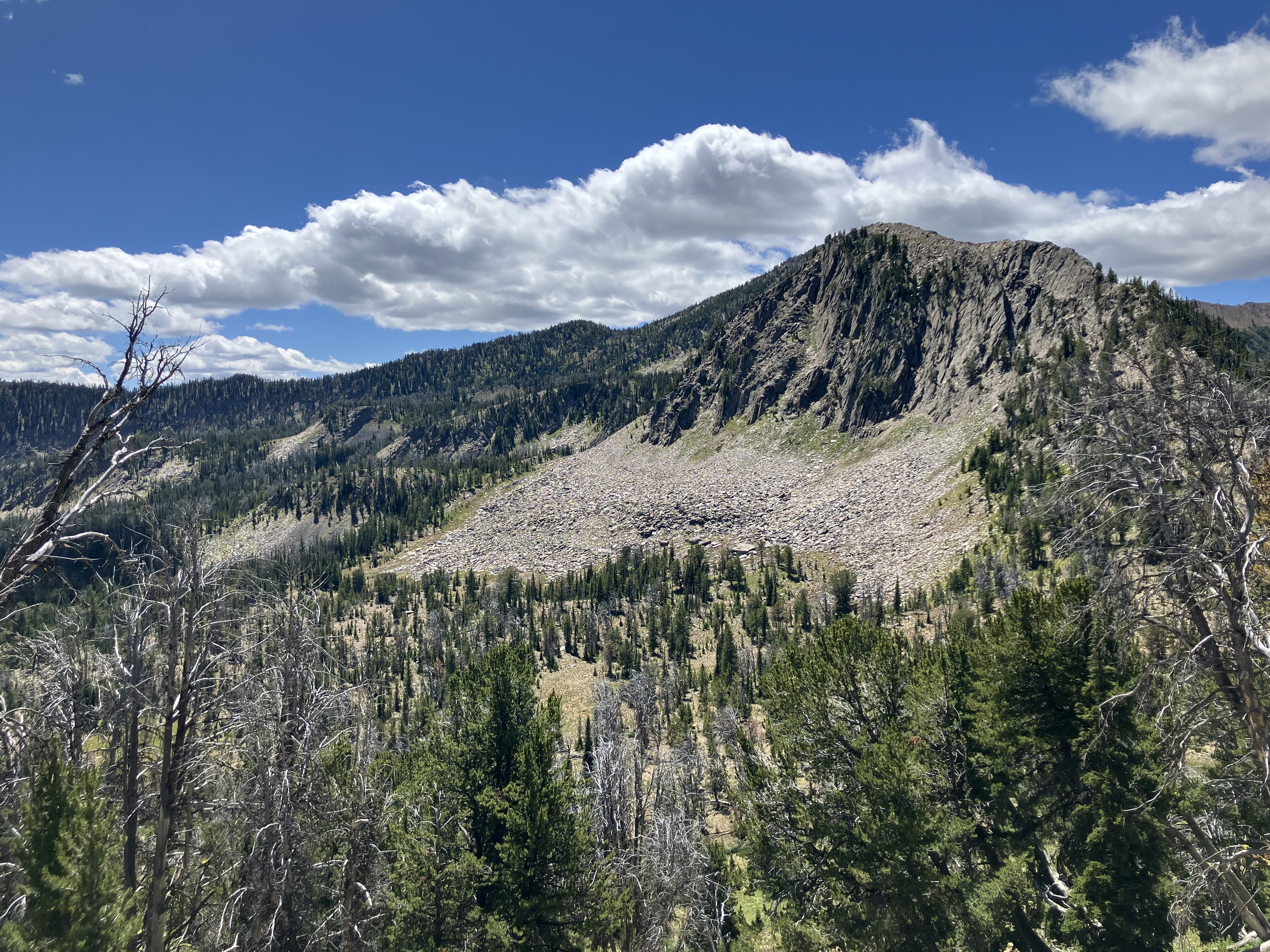
The wind picked up as we climbed along an old forest road to the ridge. Across a short descent I could see the trail switchbacking up the next mountainside, waiting. I was blown sideways by the gusts and had to use my poles to steady myself. Whenever the trail dipped behind the leeward side of the ridge, my speed shot up. We had nice views of the distant valleys and the upcoming Taylor Mountain, and Strix, Lark, and I leapfrogged our way uphill. The trail was a decommissioned mining road lined with wildflowers blowing in the breeze, and for once the climb was a constant, steady grade throughout.

Our camp spot for the night was beside a little pond just off trail, and it was completely devoid of trees. We looked around and decided to tie our bear bags to a bush and hope for the best. The pond was definitely formed by old mining operations, but it was another eight miles before the next water. We filled our bottles with water likely laced with mine tailings and tried not to worry.
Lark, Strix, and I cooked dinner together as the sun was setting. The clouds were building off in the distance, but the ones along the western horizon were a strange texture that I hadn’t seen before. I asked Lark about the forecast, and he said the Garmin had claimed it would just be cloudy overnight. “But it said the same thing right before I was almost struck by lightning two years ago,” he admitted. I kept one eye on the clouds as the strong winds died down that evening, and we all retreated into our tents as the air cooled quickly.

Day 47
The rain pattered against my tent, just a gentle tapping, and I rolled over to check that my quilt was still dry. Half-awake, I got up the courage to leave my warm tent and pee outside once the rain had stopped. It was still dark, and as I looked up to where the stars usually shone, a wall of black was advancing across the sky right toward us.
ohshitohshitohshitohsh-
I froze for a moment before scrambling back inside my tent. The first flash of lightning came, with the thunder rumbling only a few seconds afterward. We were camping at 9400’, along an exposed ridgeline just a few hundred feet below the summit. There was nothing we could do.
I curled inside my quilt to hide as another flash of lightning lit up the sky above, counting to four before the thunder followed. Rain lashed against my tent, and the wind howled along the ridge and battered against our tents. I checked my watch: 4 am. With luck the storm would be over before I needed to start packing up.
About half an hour later the wind and rain had died down, and I peeked outside the tent; I could see stars above me, and the storm seemed to have passed. The three of us took our time at breakfast that morning, recounting our individual terror from the night before. I made my oatmeal with the water from the pond, but then resolved to avoid drinking as much as possible.
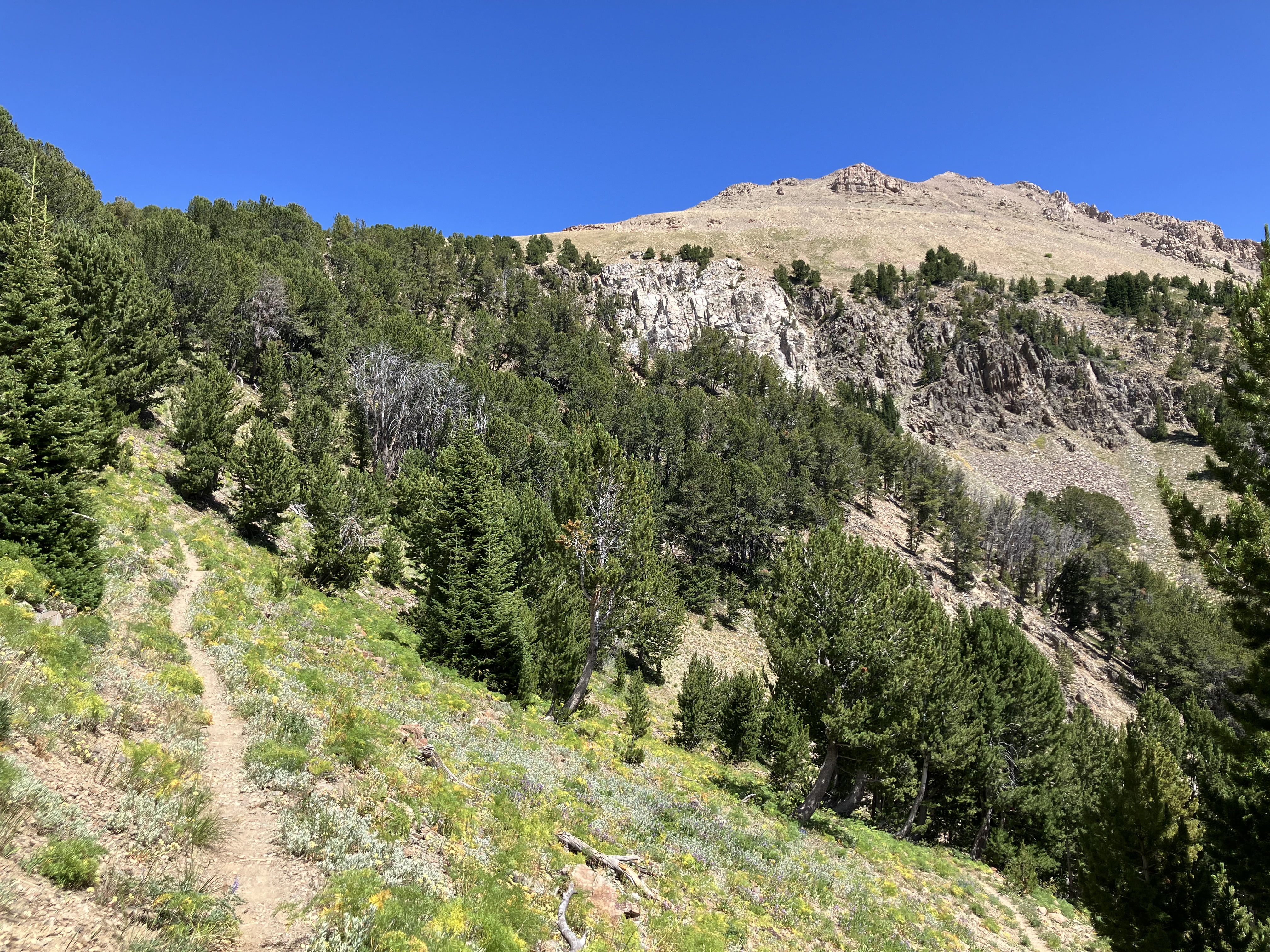
The morning was filled with wildflowers as I hiked along the decommissioned road beneath Taylor Mountain. Meanwhile off in the distance the Tetons rose jaggedly above the horizon.
I sailed down through the forest and across more meadows before climbing up a short section of road. At last I reached the spring after eight thirsty miles of drinking only half a liter. I washed out all my bottles and back flushed my filter in an attempt to rid them of phosphates from the mine water. It wasn’t long before Strix showed up, followed by Frizz and Pedicure, the two hikers we had seen running along the ridges before the road into Lima.
We stopped for lunch beside Hell Roaring Creek after fording the creek. I went back after dropping my backpack and washed some of the dirt from my feet and legs; the dry, dusty trail often turned my feet dark brown by lunchtime, and if I didn’t empty out my shoes and socks then the build-up would rub all afternoon.
I was prepared for an uphill slog in the afternoon, but I met a NOBO hiker soon after lunch who stopped to say “You’re about to have some amazing views.” And then suddenly the trail turned into a canyon.
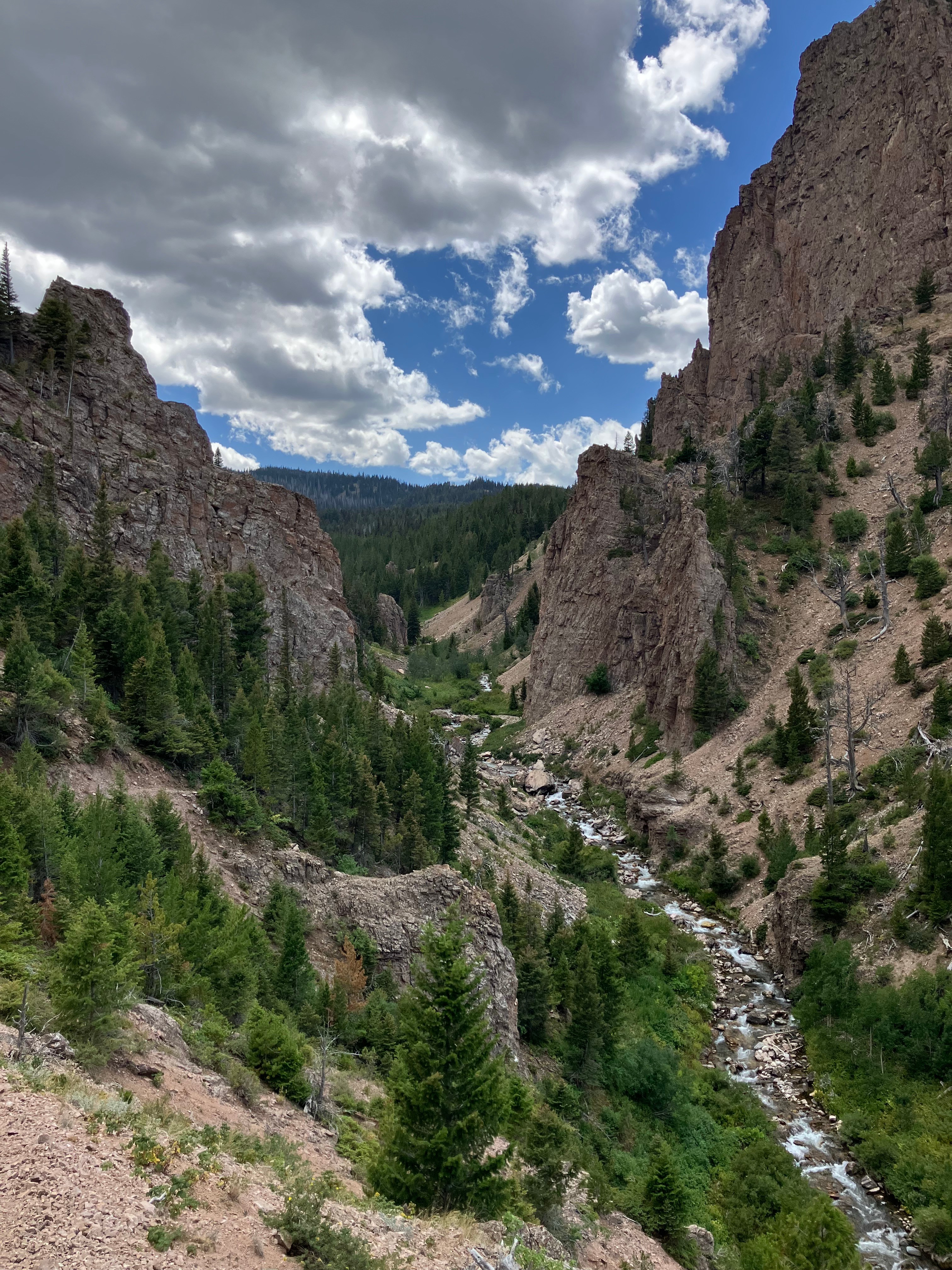
Sheer rocks jutted into the sky, and the trail narrowed along Hell Roaring Creek as it sped through the slot between the rock faces. Part of the trail had washed away, and I had to carefully pick my way across the crumbling hillside. I climbed up high above the canyon and looked out toward the distance, where the land abruptly turned to rolling grassland and pasture.
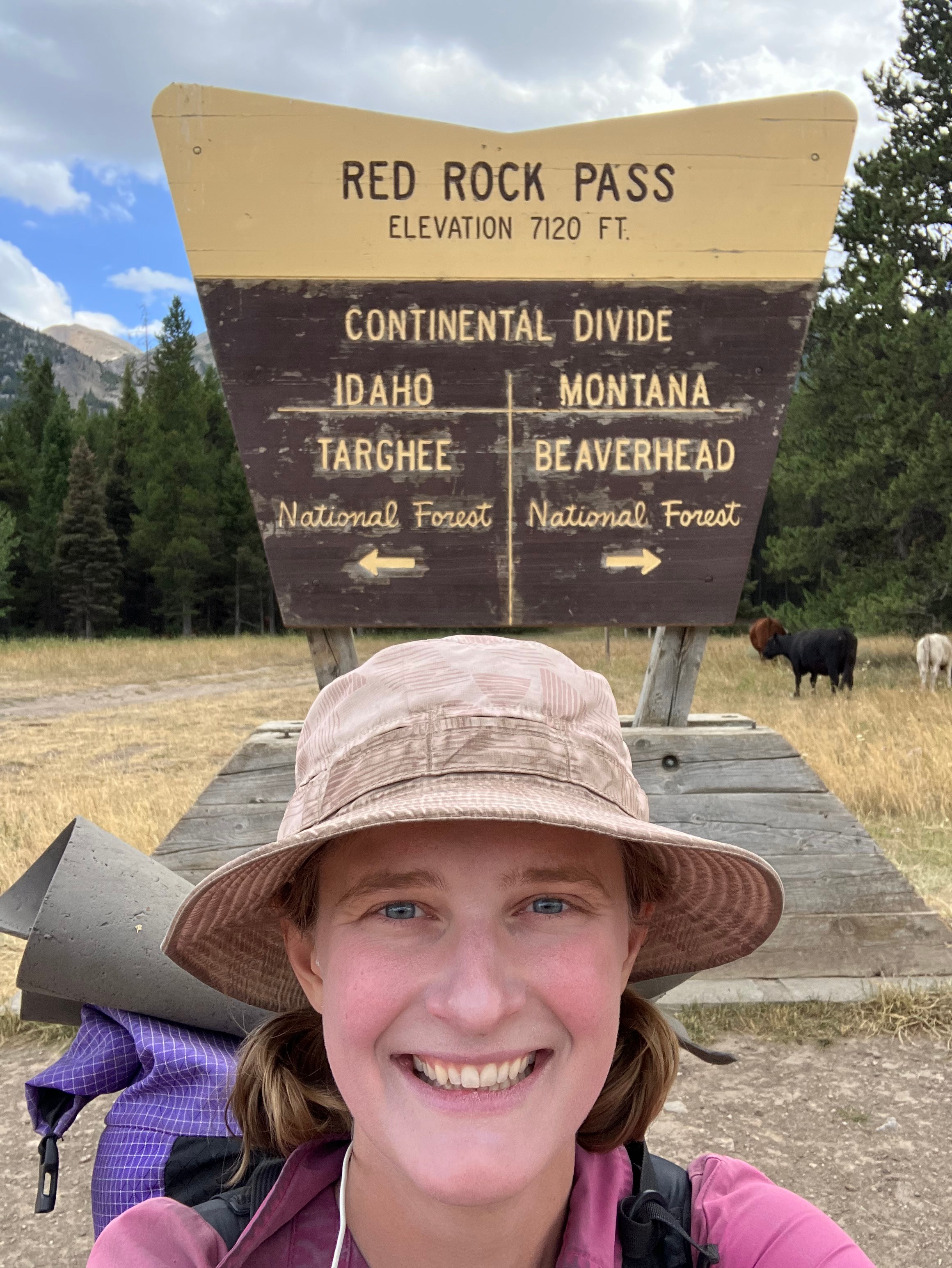
After a few miles through mixed deciduous and pine forest, I descended to Red Rock Pass, where I met a Great Divide cyclist from Geneva. He was riding on a 40-year-old bike that friends often referred to as prehistoric. He asked me what day I was on for my trip, and I asked him the date so that I could calculate. He laughed and shrugged; neither of us knew, so I estimated 45. He had started in Kalispell only 15 days ago, but his route had only covered 750 kilometers so far.
I waved goodbye and continued hiking back onto a forest road for the last five miles before camp. I passed Strix and Lark reclining beneath a tree, and then paused not long after for them to catch up as the sky above me roiled and darkened. Thankfully we were on the lagging edge of the dangerous-looking clouds, but the wind still howled along and tossed dust into our eyes. We got to our camp spot and didn’t find much in the trees near the spring, so we had to set up our tents in the meadow, right on the edge of the bushes to block as much of the wind as possible.

Day 48
The next morning was freezing – literally. Lark and Strix had frost on their tents, and I hiked in my puffy coat for the first two hours when normally I would only use my gloves in the morning chill. It would stay chilly all day; that evening Strix said the high had only been 58.
I continued on the road up to a few established campsites with a view over Henry’s Lake. As usual I took my break in the shade, but after five minutes I was shivering and hurried down the road.

The trail descended to Raynold’s Pass, where I took another photo with the latest Continental Divide sign. It was also my first time seeing a “Welcome to Idaho” sign after hiking along its border for hundreds of miles – and just as I was about to leave the state behind for good.
For the first time in weeks I had strong cell service on trail, and I took full advantage by calling Dov as I wound my way along the contouring path on the side of the mountain. I passed through stands of aspens and through meadows and sagebrush, all the while chatting on the phone. At Mile Creek I called my parents and filled them in on the latest trail excitement while filtering water for the climb ahead.
Ahead of me lay the long climb up to Targhee Pass. While the CDT loved its long sections of flat punctuated by short, steep climbs, the ascents were rarely more than a thousand feet at a time. This section, on the other hand, was several miles of steady uphill switchbacking up almost 3000’ to top out at 10,000’. It was like being back in Washington on the PCT.
I slipped into a rhythm and walked through the forest, passing massive avalanche slopes where the foliage was beginning to turn red. Coupled with the cold weather, it felt like the first announcement of autumn in the mountains.
The constant 10% grade didn’t afford many good places to sit for lunch, and so I aimed for the “false pass” partway up the climb, where others had seen a break in the trees as they climbed above one shoulder of the mountain, only to be met with another 1000’ of switchbacks on the other side.
My back had other plans. Heavy loads and steep uphills often forced me to stop more frequently to stretch, and with less than half a mile to my lunch spot, I was in too much pain to keep going. Once I had rested and stretched, I decided to skip the pass and take my lunch break at the top. For once the weather cooperated, the sky stayed free of thunderheads, and I could actually enjoy being up high among the clouds.
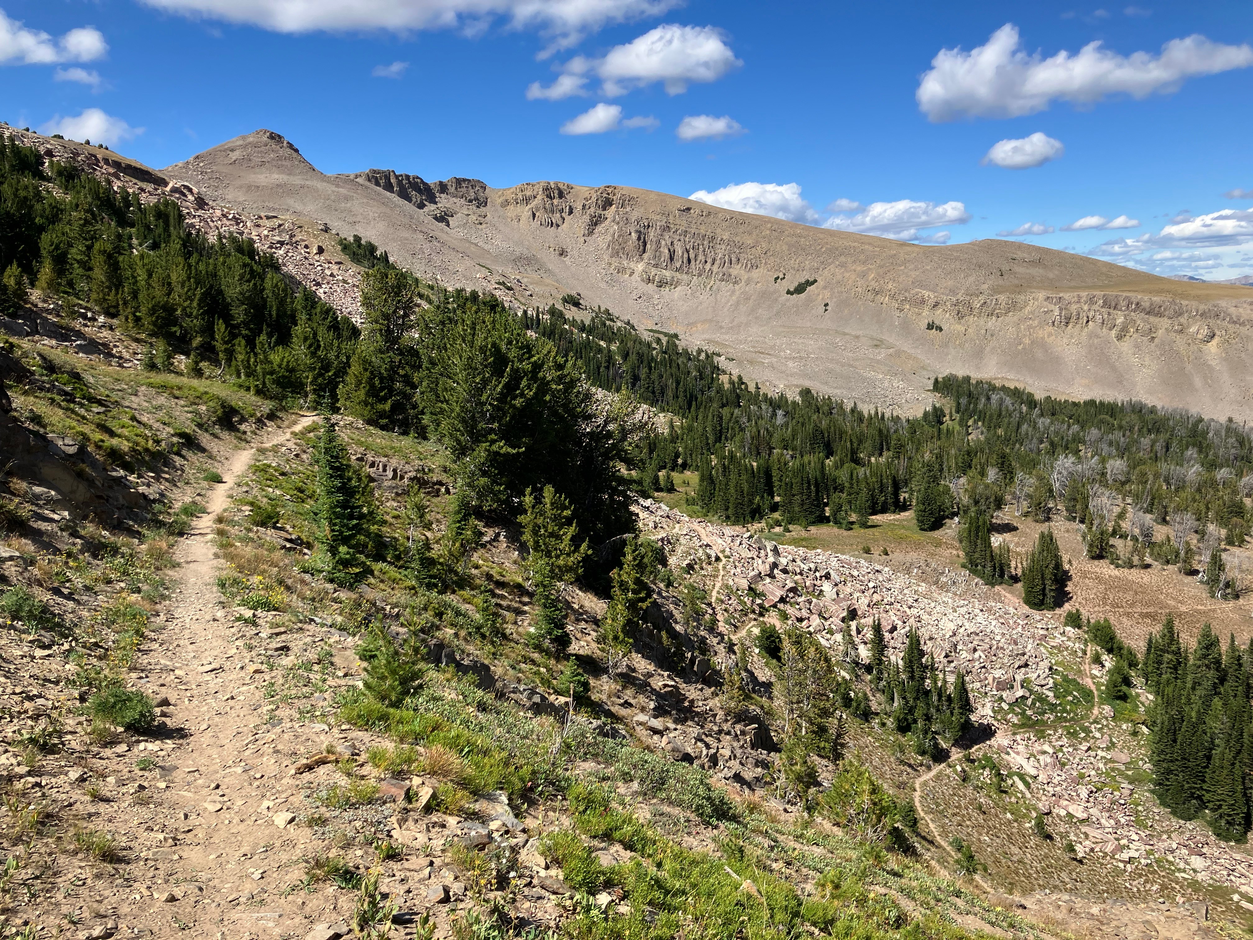
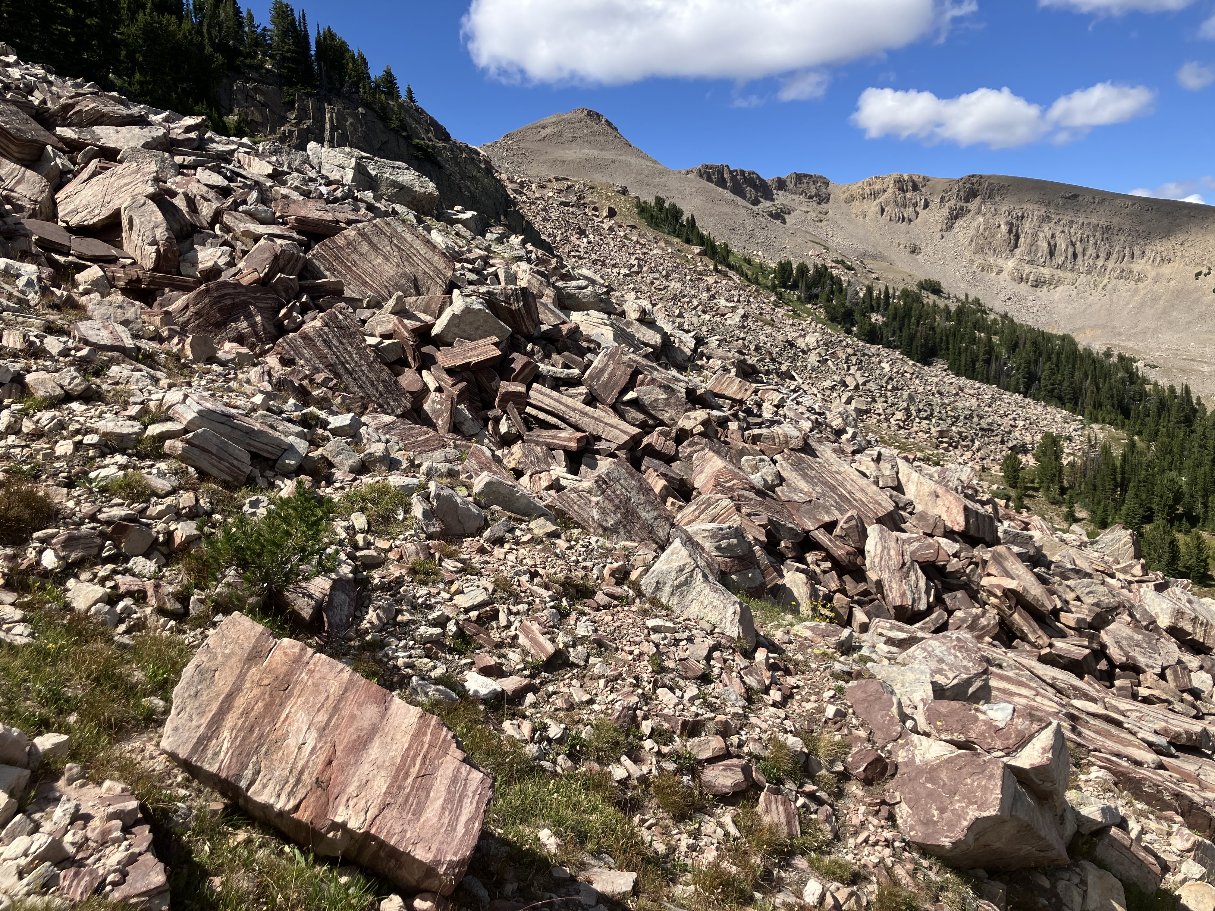
I spent a leisurely hour eating lunch at the high point, reclining in the shade and gazing out toward the area where Yellowstone lay. Strix stopped by as I was packing up and laid out her rain fly to dry in the sun. With sixteen miles down, we had fewer than five remaining to reach camp, and I sailed down the descent past a jumble of massive, striated rocks and bright green meadows. The trail led past pika squeaking among the talus field, past a series of tiny ponds on their way to drying up, and finally across the last stream before camp. There was an excellent cleared spot beneath the pines, and the three of us set up our tents and ate dinner among the wildflowers beside the trail.
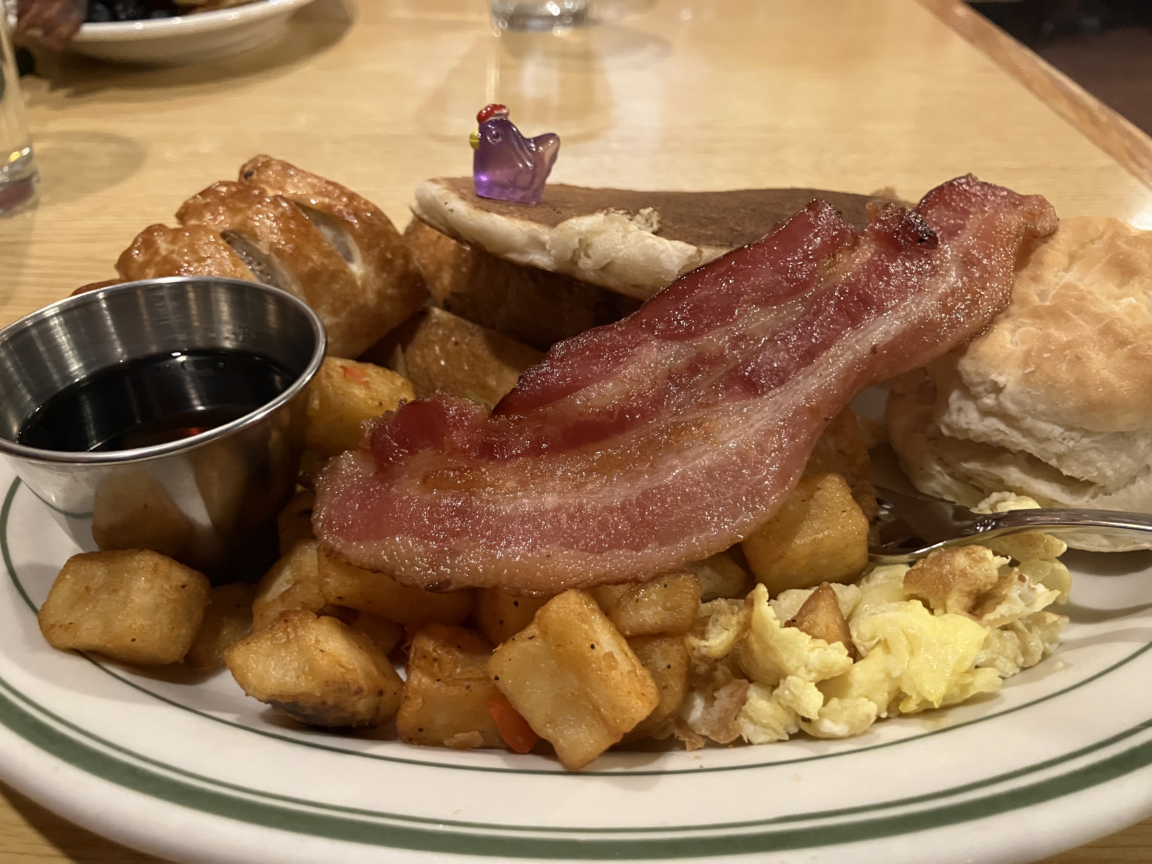
I had barely been eating my lunches in this section – one of the downsides of experimenting with new options – and had needed to ration some of my food to make sure I had enough. In short, I was supremely ready for a cheeseburger in town the next day.
Day 49
The next morning we were treated to a beautiful sunrise over the meadow. The peaks behind us were ablaze in golden light as we packed up our tents and hiked out toward the highway.
We hiked up onto the final ridge before the road and followed the rocky spine for a few miles, with intermittent views of distant geysers puffing into the sky.
Lark saw a family of mountain goats, but they were gone by the time we had caught up to him. We sailed down through the forest and along a smooth forest road before reaching the highway crossing into West Yellowstone. I passed a Welcome to Montana sign quickly followed by a Leaving Montana sign, and we made sure to stand on the MT side while trying to find a ride. Lark brought out his ground sheet, on which he had written “Hitch or Beer” – we got a few more smiles from folks driving by after that.
Hitching thankfully took only 5 minutes, and soon we were in front of the Yellowstone Beer Company – two hours before it opened.
We had lunch at a BBQ joint and killed time at a cafe when a group of other hikers ran into us. They were NOBOs, and we all headed to the brewery to hang out and swap stories. At the bar we ran into Scurvy – another hiker we had leapfrogged with in the section before Lima.
After ten long days in the woods and on the ridges, we were happy to be back in town.
One Comment
Ray
You’re in my favorite country now . . . the Greater Yellowstone Ecosystem. Hellroaring Creek . . . outstanding wild cutthroat trout. Too bad you’re not into it. And the striated rocks . . . may be a petrified forest. The fossilized trees break into chunks like that. Enjoy!