
Day 44-45: Skipping Town
August 4-5; Mile 682-718
Day 44
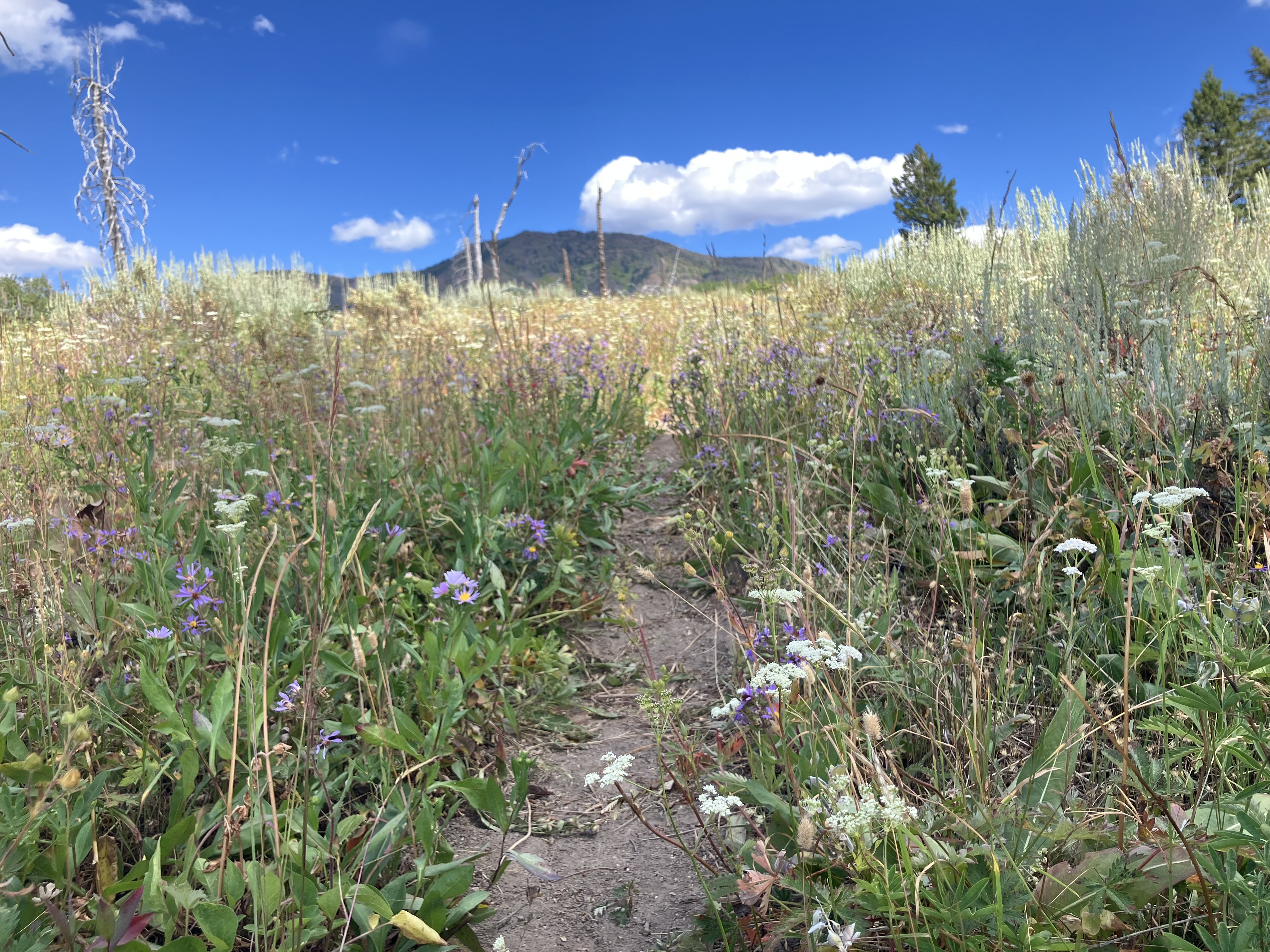
After two long days of hiking, I had to drag myself from my quilt in the cold morning air. Groggily I hiked past the sunrise and on through the sagebrush as it led into forest.
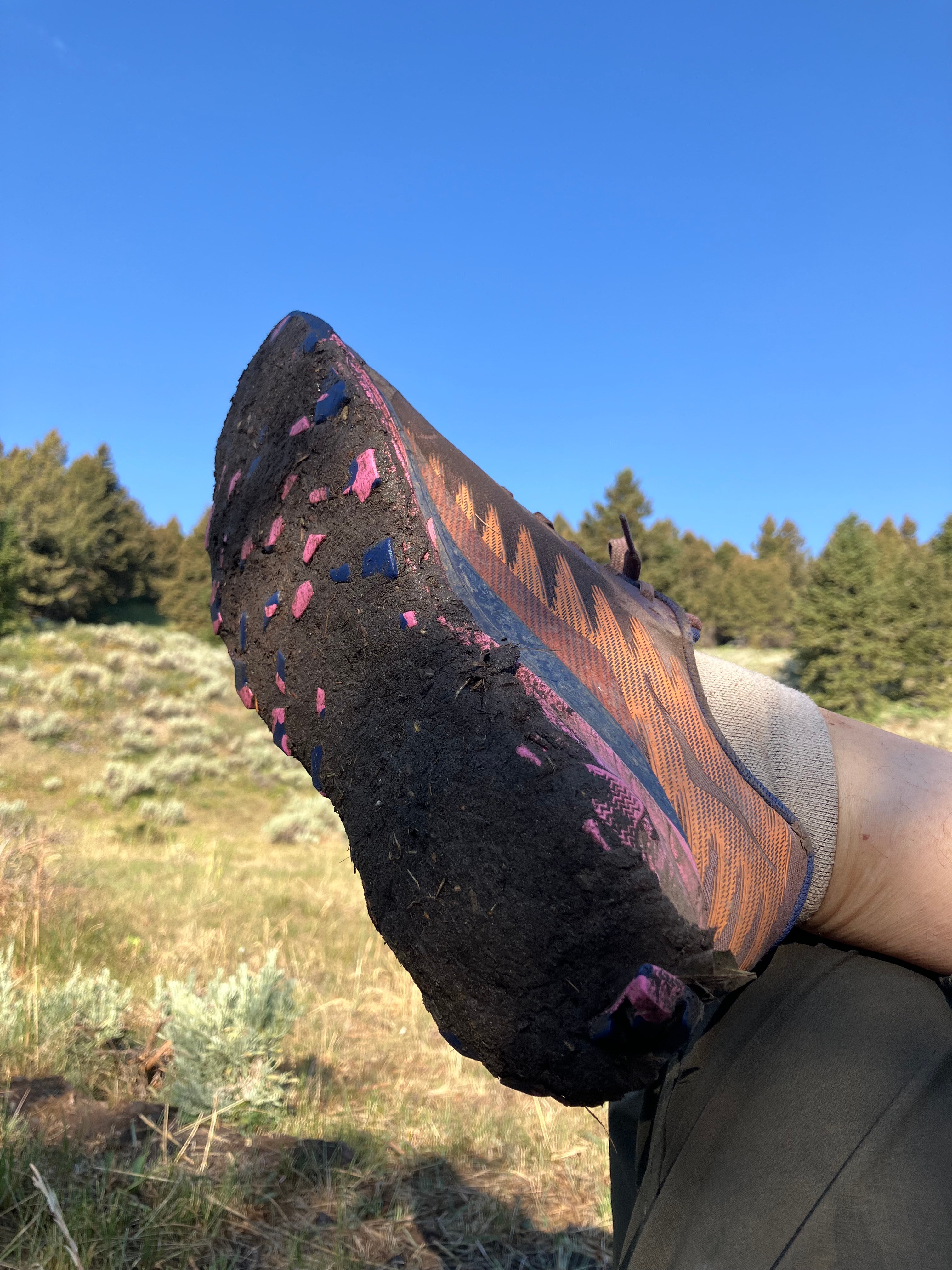
The next water source was completely trampled by cows, but I found a path on the other side leading to the left. It led gently downhill, although it passed right next to some pine trees where the branches at chest height still remained. As I got onto my hands and knees to crawl under branches for the second time in five minutes – ripping the pad on top of my backpack to shreds – I grumbled that the CDT truly only seemed to be maintained by and for the cows.
And then a second path joined into mine from the left, and I got a funny feeling. I checked my map; I had been following a literal cow path at least a quarter mile away from the trail. Cursing the cows, I went cross-country straight up the hill I was supposed to be ascending.
At the next stream crossing I was more vigilant and proactively checked my map to see where the trail led. Too late; I was already off course again?! I backtracked a tenth of a mile, running into Strix heading down the same trail I had just trodden. At the junction we both had missed, there was not a single cairn / wooden post / arrow made out of sticks. Nothing. And barely the faintest flattening of grass to signal where the trail actually lay. I let Strix go ahead this time.
And then a mile later she cursed and backtracked because we were somehow off trail AGAIN. The damned cows had absolutely trampled the trail near all the water sources, and elsewhere they had set down tracks that were better established than the CDT.
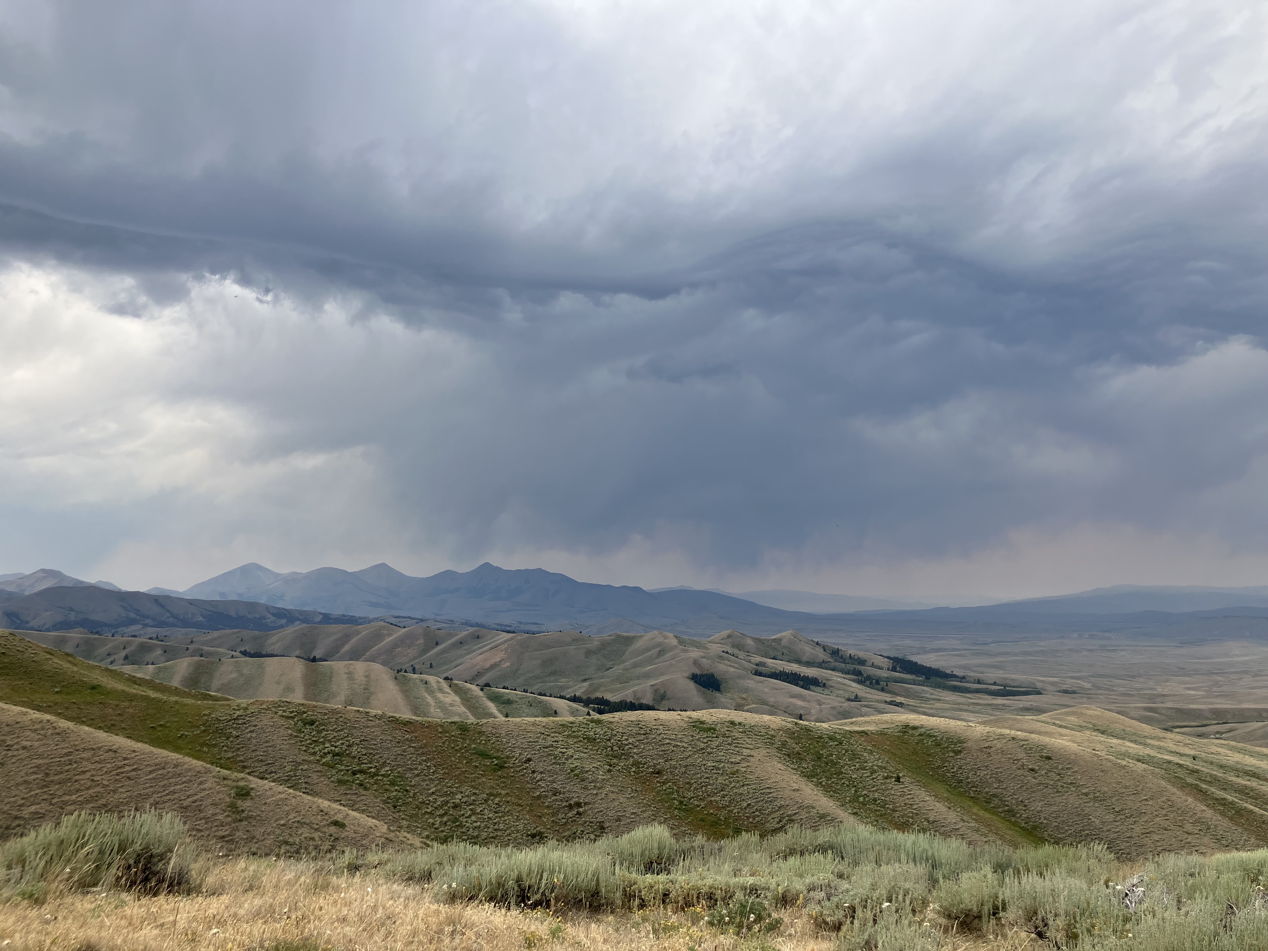
We filled up on water near Beaver Creek, our last on-trail source for the day. From there the trail climbed high away from the trees and the streams, sailing upward into sagebrush and sky. We were back on the true divide, with miles of exposed ridgeline between us and the road.
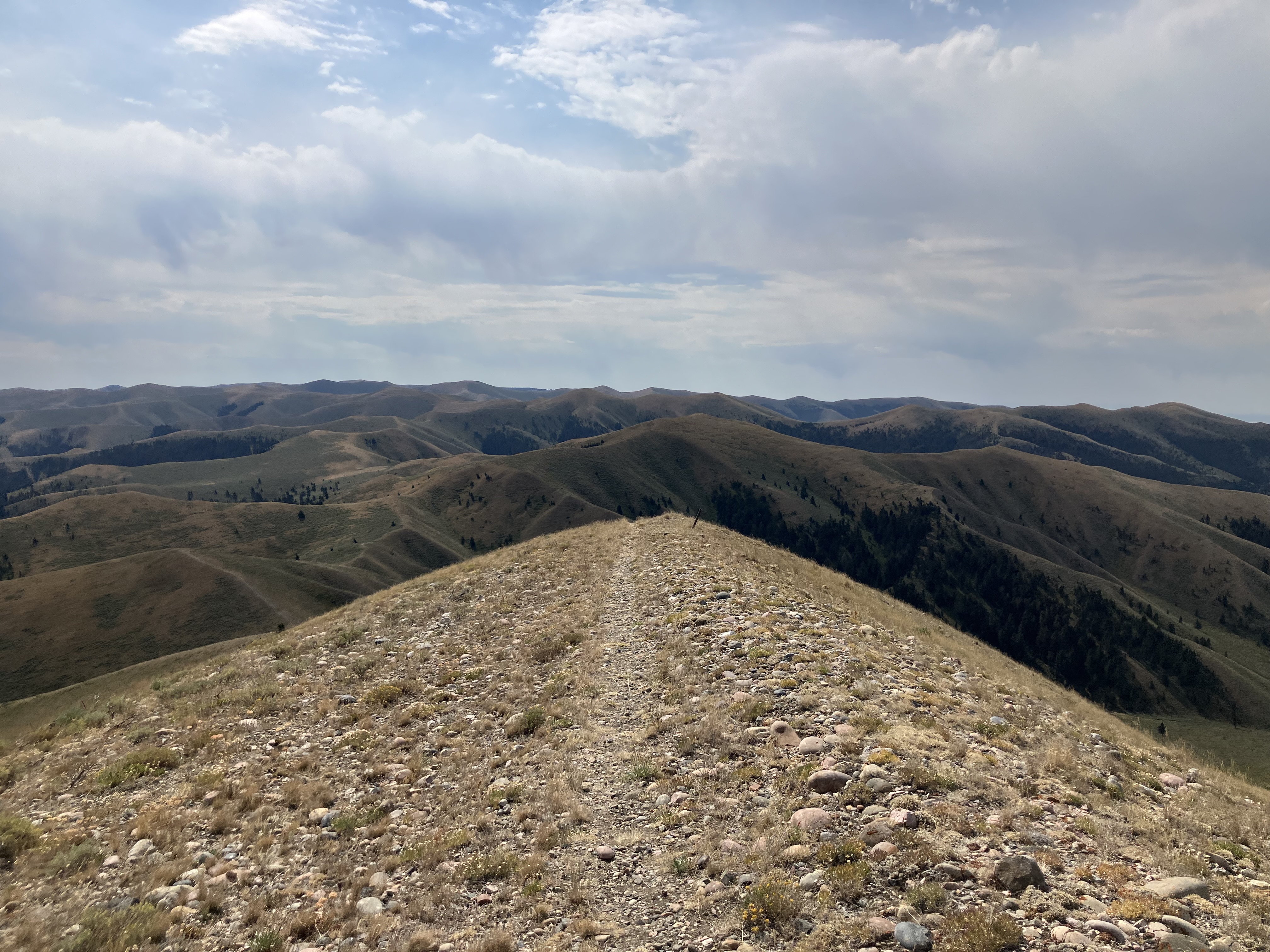
The grade was steep, averaging more than 10% for the entire day, and close to 25% on the steepest climbs. Thankfully up here there were no questions about which way to go. At least we thought so, until we walked past a few downed trail posts and ended up doing extra climbing where the trail contoured instead of sticking to the top of the ridge. This was going to be the longest 17 miles I had ever hiked with all the detours.
It was an austere land we walked through. Clouds darkened and swirled ahead, but thankfully storms held off. We would have had to run down the side of the hill to the trees several hundred feet below us if we heard thunder. Two other hikers – Frizz and Pedicure – passed us on their way to town, and we watched in awe as they ran the downhill stretches. Apparently they had run out of food.
We didn’t even stop for lunch, so determined were we to get down and to our next adventure: an outdoor shower provided by Handy’s dad at Modoc Road. He had cold beverages, gallons of hot water, a tarp rigged up as a shower curtain, and recliner lawn chairs. It was pure heaven to skip dealing with a tiny town and have our resupply brought to us. I even was able to do some bucket laundry, since my socks were almost black from dirt and grime.
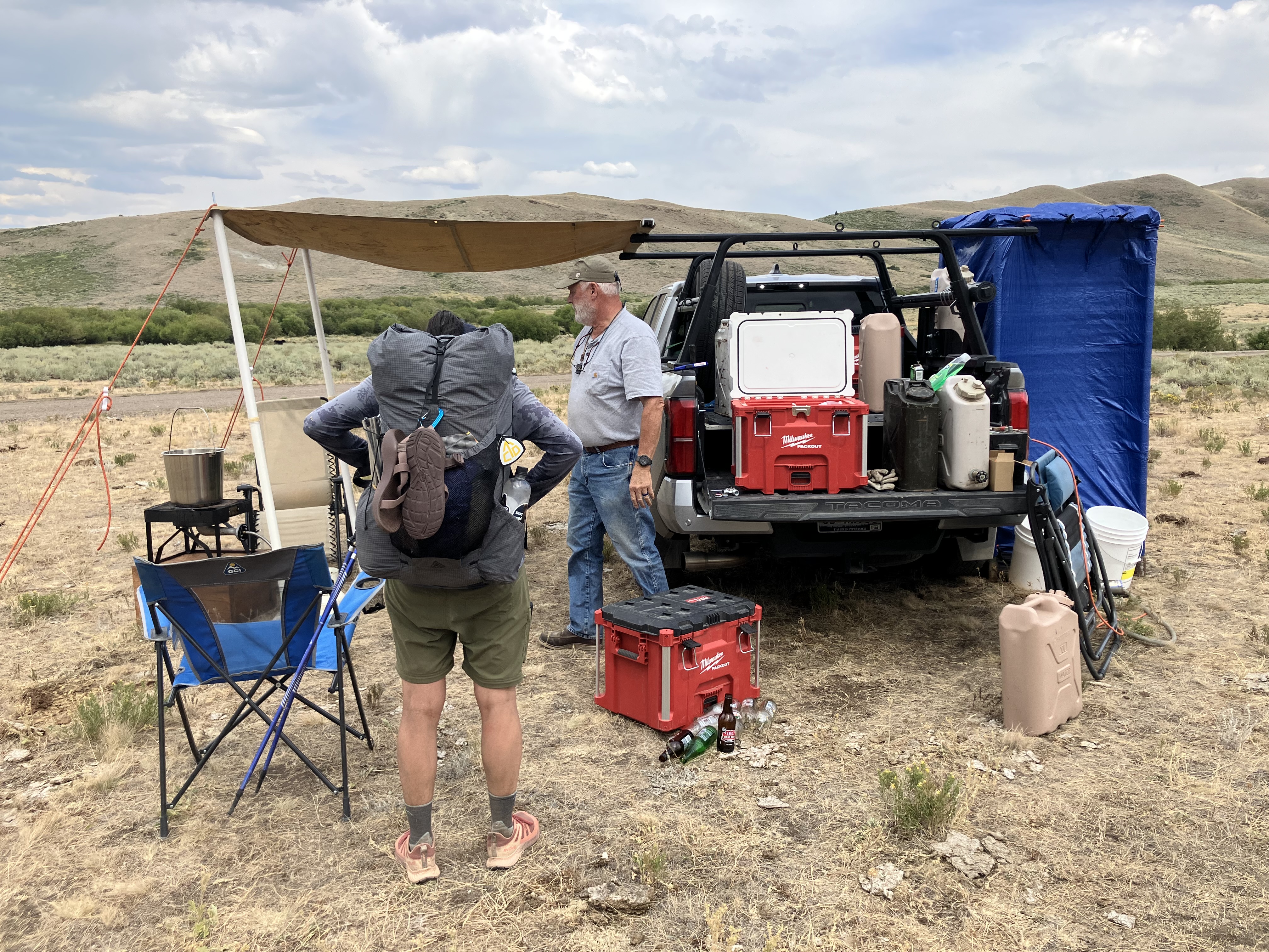
He drove us a few miles down the road to avoid the hot, shadeless walk near I-15.
We found an excellent camp spot under some trees, and I set my alarm almost an hour later than usual. After the past few days, I had earned the right to sleep in.
Day 45
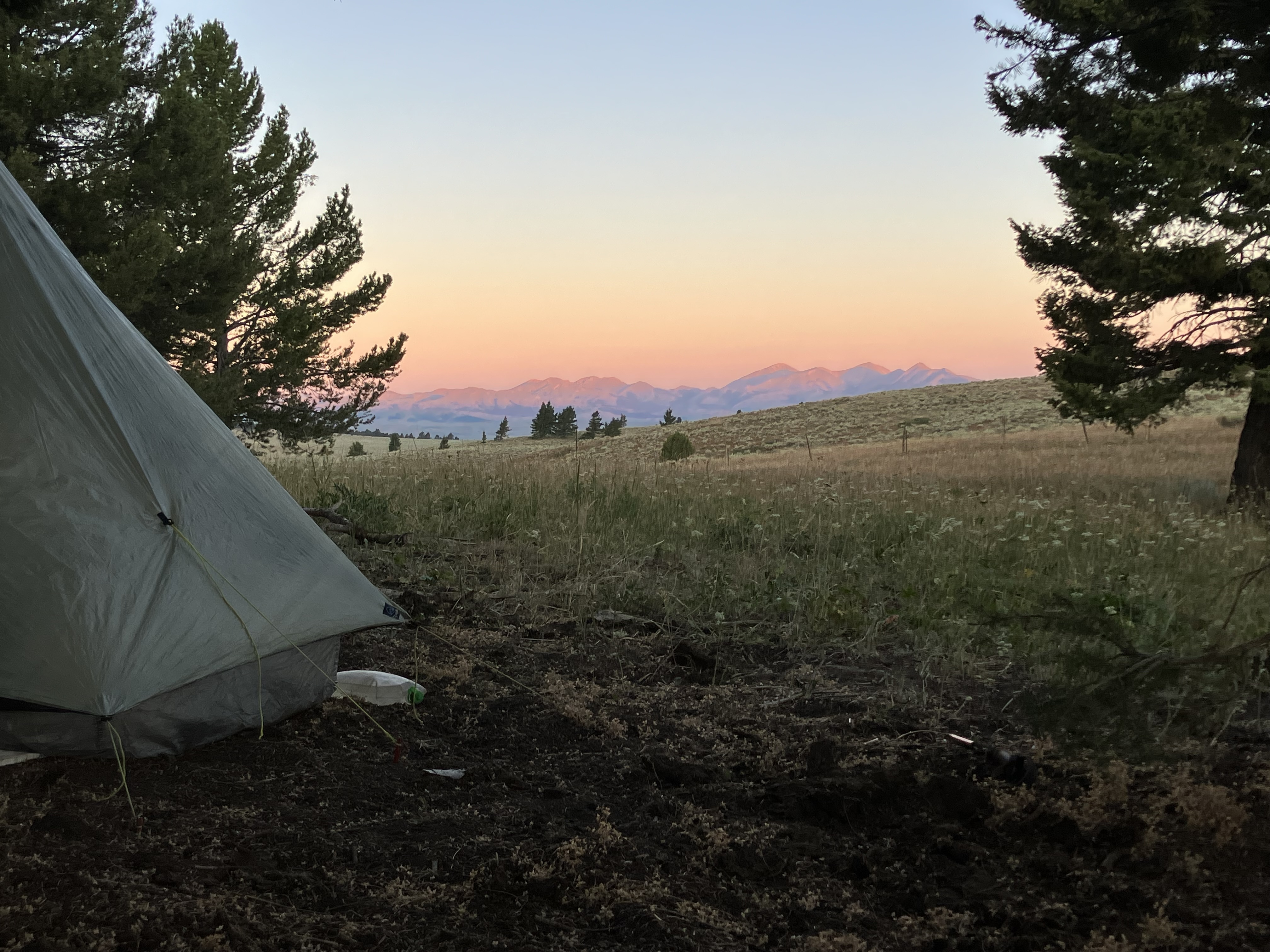
The next morning I watched the sky turn pink and orange while snuggled inside my quilt. I had breakfast with Strix and Lark at camp before hiking out with Strix in the cold, clear light. We shivered our way through the sections of shade before climbing up the road to the trail turn-off. Another register lay waiting, our second in 12 hours, and only the second of the entire trail. After signing our names (and checking for familiar names… Jessica now going as Baba Yaga, Steamy and Panty Pirate, Treebeard, Whimsy, Knotty, Rally, Pop… all 1-2 days ahead of us), we stepped off the road and back onto trail.
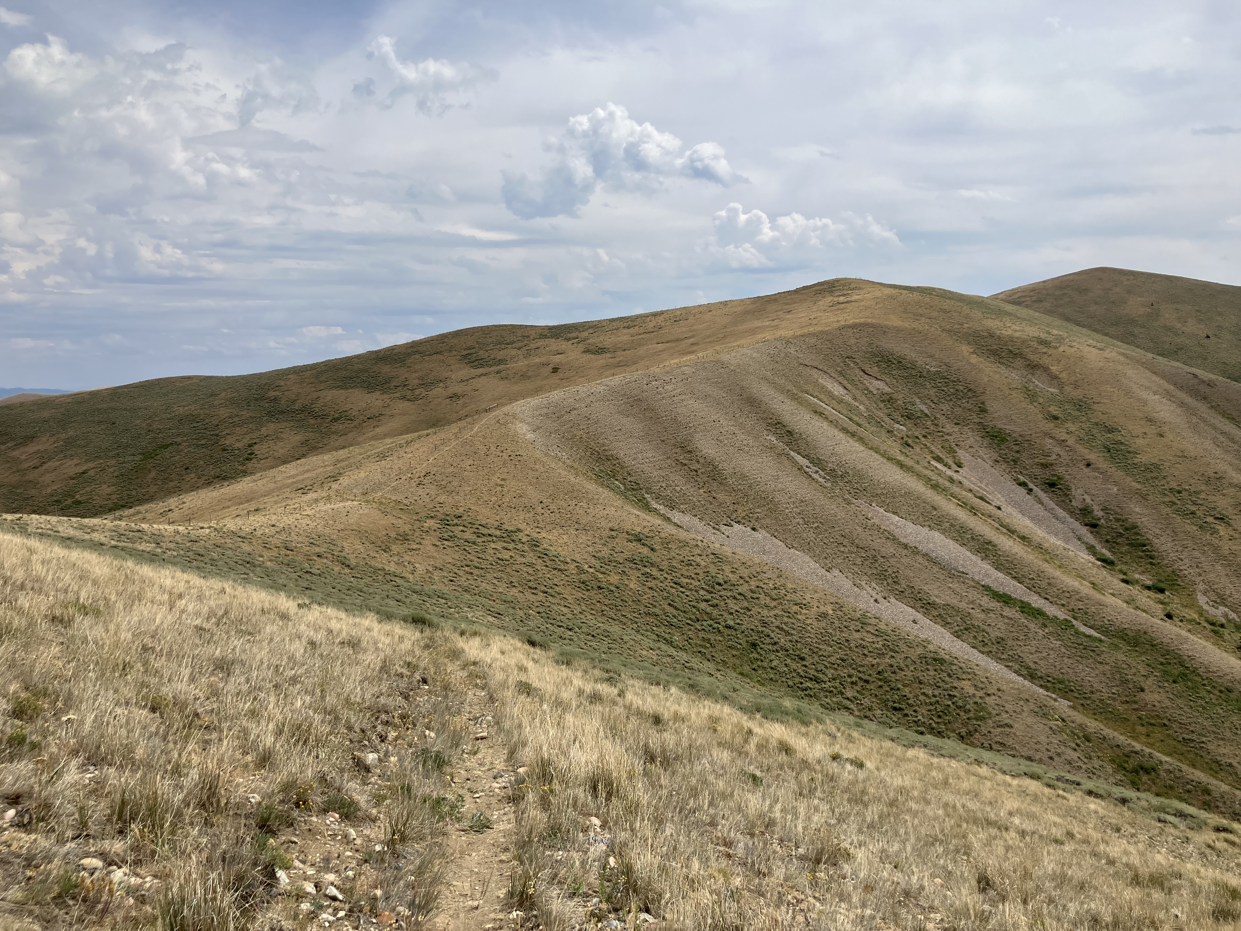
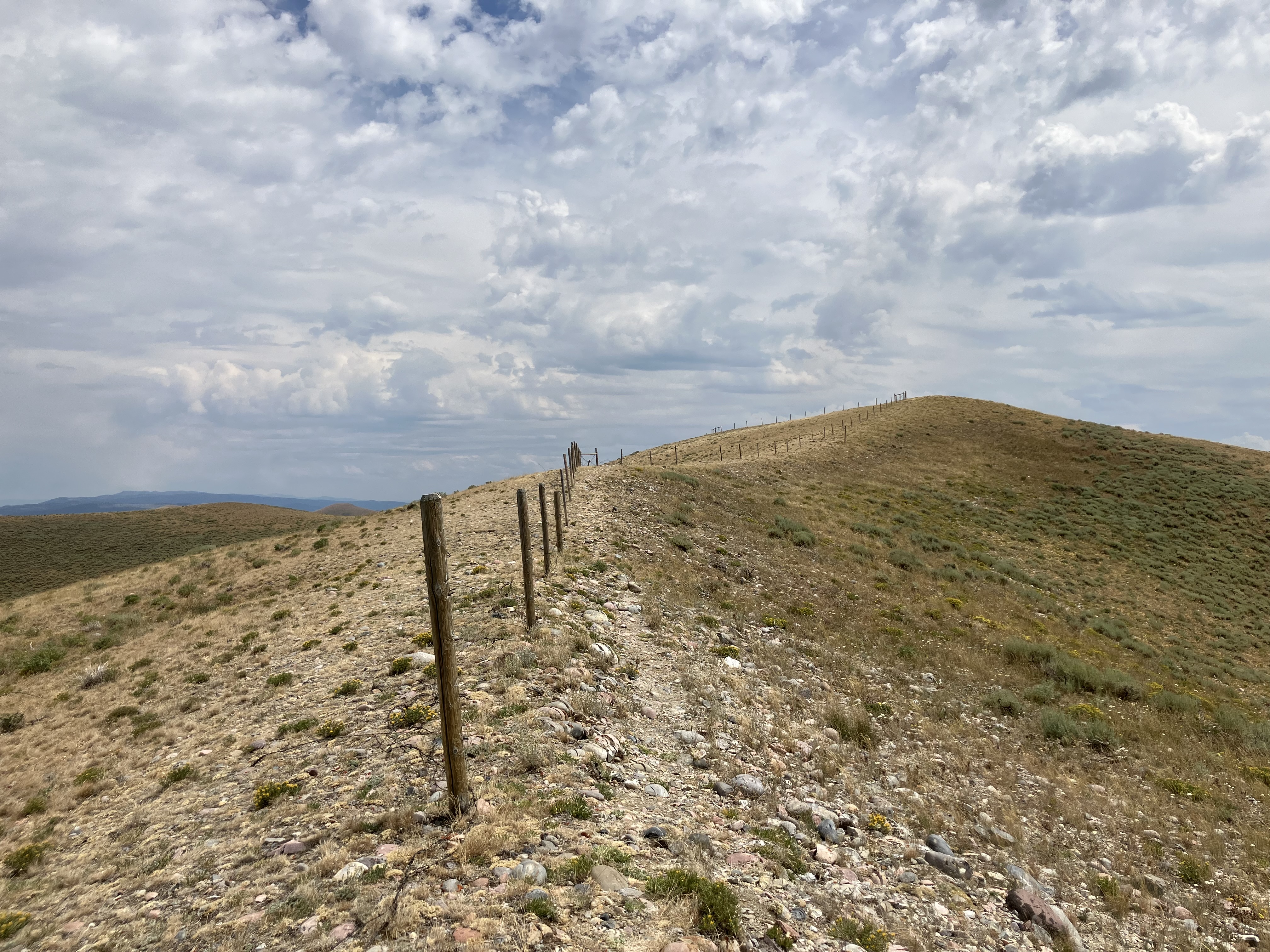
Our altitude was still high – about 8500’ – but without the steep drainages and deep descending views of the day before, it felt like we were walking along a little plateau barely above sea level.
We walked through grassland with occasional trees for shade, and Strix paused beneath one to do the NYT morning puzzles since she was lucky enough to have cell service. I hiked on, heading back into forest. AT&T had failed me yet again.
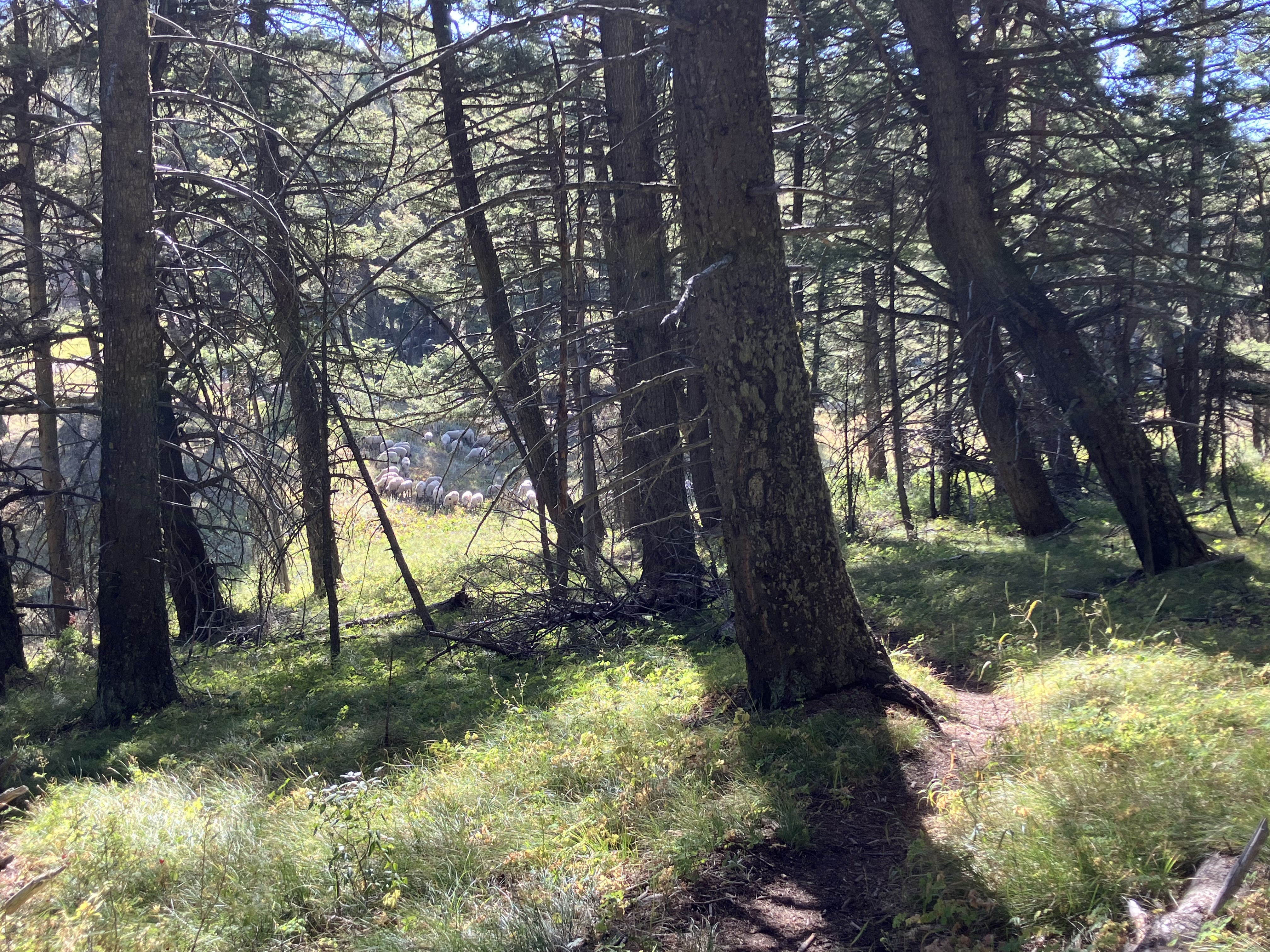
Through the trees I heard an odd wailing sound, and as I neared it resolved into loud bleating. A flock of sheep was munching their way through the forest. I had hit morning rush hour traffic on the CDT: they were right on trail, of course, and I approached slowly. I was looking to see if there was a way to bushwhack around them when the sheepdogs barked a warning. I stopped and backed up, found a spot in the shade, and settled down to wait. I’d read about other hikers being accosted by the dogs and wanted no part of that. Thankfully the herd was moving south a bit, and I was able to hike up the hill on the trail and leave behind the incessant baaing. As I passed a greenish pond, I startled two does and sent them prancing up the hill.
The trail led up steeply to a rocky ridge that meandered up and down before heading through more grasslands to Rock Spring. Strix and I stopped there for lunch, and in the shade of the large tree we actually had to pull on our puffy jackets to stay warm. Lark never showed up, and Strix said “There were no streams or lakes for fishing, I wonder what delayed him this time.” We learned later that he had taken a cow path on accident and needed to bushwhack 3 miles around Little Table Mountain to get back to trail.
Much of the afternoon was spent gliding along the ridge through fields of shriveling wildflowers, the leaves rattling in the breezes. The sun blazed above, but the wind gusted frequently and kept the temperature fairly pleasant.
At last I reached the small lake where we would be camping at a nice spot in the trees. My heavy pack thudded onto the ground, and I looked forward to eating through some of the food weight to lighten my load.
Lark showed up around dinner time, and the three of us ate together and made the mistake of talking about town food. It was far too early to be thinking of cheeseburgers, and though we had enjoyed our speedy turn-around at Modoc Road, this was one of the downsides. It would be ten days between when we got to eat food that hadn’t been dried or dehydrated first.
As I was reading in my tent before bed, Strix called out, “Guys! There’s a moose!” It was on the hill behind our camp spot, maybe 50 yards away. We all climbed out to watch it saunter along before disappearing over the top of the rise.
2 Comments
Kate
A random thought: have you ever met people with the same trail name? Is there another “Stormy” out there somewhere? Another “Panty Pirate”? Is there an adjudicating body that has to approve trail names?
Back to the trail: do sheep always form a big ring like that? Except for the ubiquity of cowpats and the lack of good markings on the trail, leading to backtracking, it looks like a wonderful day; the scenery is really beautiful. You get such diversity of weather, terrain, flora and fauna. And your pictures are so wonderful, capturing all of that diversity. Thanks for keeping this blog going!
Jack
I can almost smell your shoe from here!! Great reporting!